Forest Hill night lights from space
Night Light of Forest Hill (Victoria) from space (Australia) Src. Average luminocity for 10x10km area is 77.0663% and for 50x50km: 46.2698%.
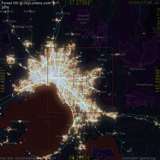
Analysis of Forest Hill night lights 2016
Square area 10x10 km:
 13.78%
90-99
16.84%80-89
9.18%70-79
18.88%60-69
28.91%50-59
10.03%40-49
2.38%30-39
0%20-29
0%10-19
0%0-9
0%Square area 50x50 km:
11.47%90-99
10.68%80-89
5.66%70-79
8.57%60-69
7.6%50-59
5.66%40-49
3.58%30-39
3.21%20-29
4.55%10-19
7.34%0-9
31.67%Clear (daylight) street map image can be seen on geolist.org.
Map coordinates:
37° 16' 33.3" South, 144° 28' 48.8" East
37° 49' 60" South, 145° 10' 60" East
38° 23' 11.6" South, 145° 53' 11.3" East
Some cities around Forest Hill sort by population:
• Mitcham
2.4 km =1.5 mi,  38°
38°
• Wantirna
3.5 km =2.2 mi,  122°
122°
• Blackburn
3.1 km =1.9 mi,  301°
301°
• Nunawading
1.7 km =1.1 mi,  327°
327°
• Vermont South
2.7 km =1.7 mi,  181°
181°
• Blackburn South
2.5 km =1.6 mi,  253°
253°
• Vermont
1 km =0.6 mi,  108°
108°
• Burwood East
3.5 km =2.2 mi,  237°
237°
2166340 (p: 10,632)
Sources (retrieved 2019-11-25):
» Earth at Night: Flat Maps 2012, 2016