Vermont night lights from space
Night Light of Vermont (Victoria) from space (Australia) Src. Average luminocity for 10x10km area is 77.5221% and for 50x50km: 45.377%.
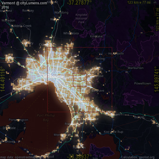
Analysis of Vermont night lights 2016
Square area 10x10 km:
 16.16%
90-99
15.14%80-89
8.84%70-79
19.56%60-69
28.91%50-59
10.03%40-49
1.36%30-39
0%20-29
0%10-19
0%0-9
0%Square area 50x50 km:
11.11%90-99
10.44%80-89
5.61%70-79
8.39%60-69
7.47%50-59
5.69%40-49
3.56%30-39
3.16%20-29
4.43%10-19
7.42%0-9
32.73%Clear (daylight) street map image can be seen on geolist.org.
Map coordinates:
37° 16' 43.6" South, 144° 29' 28.2" East
37° 50' 10.2" South, 145° 11' 39.4" East
38° 23' 21.7" South, 145° 53' 50.7" East
Some cities around Vermont sort by population:
• Ringwood
4.1 km =2.5 mi,  57°
57°
• Mitcham
2.2 km =1.4 mi,  13°
13°
• Wantirna
2.5 km =1.6 mi,  128°
128°
• Blackburn
4.1 km =2.5 mi,  297°
297°
• Nunawading
2.6 km =1.6 mi,  313°
313°
• Forest Hill
1 km =0.6 mi,  288°
288°
• Blackburn South
3.4 km =2.1 mi,  263°
263°
• Burwood East
4.2 km =2.6 mi,  248°
248°
2145267 (p: 10,239)
Sources (retrieved 2019-11-25):
» Earth at Night: Flat Maps 2012, 2016