Norman Park night lights from space
Night Light of Norman Park (Queensland) from space (Australia) Src. Average luminocity for 10x10km area is 93.8988% and for 50x50km: 45.3823%.
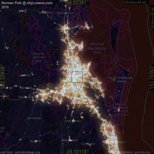
Analysis of Norman Park night lights 2016
Square area 10x10 km:
 36.71%
90-99
39.29%80-89
11.11%70-79
12.7%60-69
0.2%50-59
0%40-49
0%30-39
0%20-29
0%10-19
0%0-9
0%Square area 50x50 km:
8.82%90-99
9.58%80-89
5.69%70-79
6.46%60-69
12.29%50-59
4.31%40-49
4.53%30-39
4.54%20-29
7.42%10-19
10.59%0-9
25.79%Clear (daylight) street map image can be seen on geolist.org.
Map coordinates:
26° 51' 13" South, 152° 21' 33.8" East
27° 28' 45" South, 153° 3' 45" East
28° 6' 4.2" South, 153° 45' 56.3" East
Some cities around Norman Park sort by population:
• Coorparoo
1.6 km =1 mi,  194°
194°
• New Farm
1.9 km =1.2 mi,  312°
312°
• Camp Hill
2.1 km =1.3 mi,  139°
139°
• Morningside
2.3 km =1.4 mi,  32°
32°
• Kangaroo Point
2.6 km =1.6 mi,  275°
275°
• Woolloongabba
2.8 km =1.7 mi,  247°
247°
• East Brisbane
1.8 km =1.1 mi,  263°
263°
• Teneriffe
3 km =1.9 mi,  329°
329°
2207250 (p: 6,118)
Sources (retrieved 2019-11-25):
» Earth at Night: Flat Maps 2012, 2016