Morningside night lights from space
Night Light of Morningside (Queensland) from space (Australia) Src. Average luminocity for 10x10km area is 94.9008% and for 50x50km: 44.5221%.
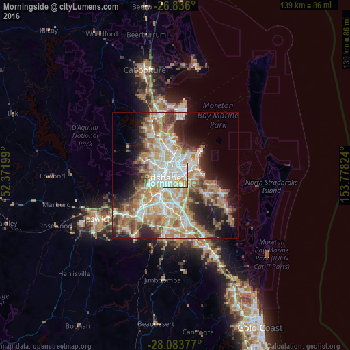
Analysis of Morningside night lights 2016
Square area 10x10 km:
 38.89%
90-99
41.07%80-89
9.72%70-79
10.32%60-69
0%50-59
0%40-49
0%30-39
0%20-29
0%10-19
0%0-9
0%Square area 50x50 km:
8.79%90-99
9.58%80-89
5.7%70-79
6.37%60-69
11.64%50-59
4.11%40-49
4.38%30-39
4.47%20-29
7.14%10-19
9.68%0-9
28.14%Clear (daylight) street map image can be seen on geolist.org.
Map coordinates:
26° 50' 9.6" South, 152° 22' 19.2" East
27° 27' 41.9" South, 153° 4' 30.4" East
28° 5' 1.6" South, 153° 46' 41.7" East
Some cities around Morningside sort by population:
• New Farm
2.7 km =1.7 mi,  255°
255°
• Camp Hill
3.5 km =2.2 mi,  178°
178°
• Hamilton
2.8 km =1.7 mi,  334°
334°
• Bulimba
2.2 km =1.4 mi,  307°
307°
• Norman Park
2.3 km =1.4 mi,  212°
212°
• East Brisbane
3.7 km =2.3 mi,  234°
234°
• Cannon Hill
2.3 km =1.4 mi,  121°
121°
• Teneriffe
2.9 km =1.8 mi,  283°
283°
9957543 (p: 10,176)
Sources (retrieved 2019-11-25):
» Earth at Night: Flat Maps 2012, 2016