Bulimba night lights from space
Night Light of Bulimba (Queensland) from space (Australia) Src. Average luminocity for 10x10km area is 96.0179% and for 50x50km: 44.3546%.
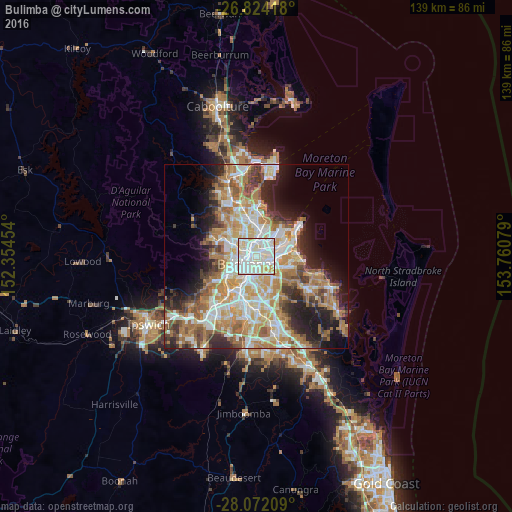
Analysis of Bulimba night lights 2016
Square area 10x10 km:
 40.67%
90-99
42.26%80-89
12.7%70-79
4.37%60-69
0%50-59
0%40-49
0%30-39
0%20-29
0%10-19
0%0-9
0%Square area 50x50 km:
8.86%90-99
9.55%80-89
5.66%70-79
6.29%60-69
11.55%50-59
4.1%40-49
4.51%30-39
4.51%20-29
6.93%10-19
9.36%0-9
28.67%Clear (daylight) street map image can be seen on geolist.org.
Map coordinates:
26° 49' 27" South, 152° 21' 16.3" East
27° 26' 59.6" South, 153° 3' 27.6" East
28° 4' 19.5" South, 153° 45' 38.8" East
Some cities around Bulimba sort by population:
• New Farm
2.2 km =1.4 mi,  204°
204°
• Morningside
2.2 km =1.4 mi,  127°
127°
• Fortitude Valley
2.7 km =1.7 mi,  252°
252°
• Hamilton
1.3 km =0.8 mi,  22°
22°
• Windsor
3.2 km =2 mi,  297°
297°
• Norman Park
3.3 km =2.1 mi,  171°
171°
• Ascot
2 km =1.2 mi,  0°
0°
• Teneriffe
1.2 km =0.7 mi,  237°
237°
2207247 (p: 6,612)
Sources (retrieved 2019-11-25):
» Earth at Night: Flat Maps 2012, 2016