Mirrabooka night lights from space
Night Light of Mirrabooka (Western Australia) from space (Australia) Src. Average luminocity for 10x10km area is 89.5238% and for 50x50km: 38.4288%.
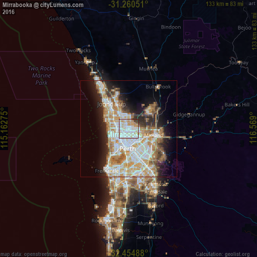
Analysis of Mirrabooka night lights 2016
Square area 10x10 km:
 33.88%
90-99
33.33%80-89
11.72%70-79
11.17%60-69
4.58%50-59
0.55%40-49
1.28%30-39
2.75%20-29
0.73%10-19
0%0-9
0%Square area 50x50 km:
8.92%90-99
9.73%80-89
4.52%70-79
5.93%60-69
6.54%50-59
3.72%40-49
2.48%30-39
3.27%20-29
6.03%10-19
8.62%0-9
40.23%Clear (daylight) street map image can be seen on geolist.org.
Map coordinates:
31° 15' 37.8" South, 115° 9' 45.9" East
31° 51' 34.7" South, 115° 51' 57.1" East
32° 27' 17.6" South, 116° 34' 8.4" East
Some cities around Mirrabooka sort by population:
• Dianella
3.2 km =2 mi,  169°
169°
• Ballajura
3.5 km =2.2 mi,  52°
52°
• Balga
2.5 km =1.6 mi,  281°
281°
• Nollamara
3 km =1.9 mi,  220°
220°
• Girrawheen
3.2 km =2 mi,  310°
310°
• Noranda
3.5 km =2.2 mi,  115°
115°
• Alexander Heights
3.6 km =2.2 mi,  358°
358°
• Westminster
2.7 km =1.7 mi,  250°
250°
8349445 (p: 8,085)
Sources (retrieved 2019-11-25):
» Earth at Night: Flat Maps 2012, 2016