Westminster night lights from space
Night Light of Westminster (Western Australia) from space (Australia) Src. Average luminocity for 10x10km area is 94.0183% and for 50x50km: 38.7127%.
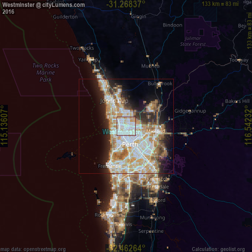
Analysis of Westminster night lights 2016
Square area 10x10 km:
 37.91%
90-99
39.01%80-89
12.09%70-79
8.97%60-69
2.01%50-59
0%40-49
0%30-39
0%20-29
0%10-19
0%0-9
0%Square area 50x50 km:
8.99%90-99
9.81%80-89
4.54%70-79
6.02%60-69
6.66%50-59
3.76%40-49
2.49%30-39
3.27%20-29
6.04%10-19
8.58%0-9
39.84%Clear (daylight) street map image can be seen on geolist.org.
Map coordinates:
31° 16' 6.1" South, 115° 8' 9.9" East
31° 52' 2.8" South, 115° 50' 21.1" East
32° 27' 45.5" South, 116° 32' 32.4" East
Some cities around Westminster sort by population:
• Dianella
3.9 km =2.4 mi,  126°
126°
• Balga
1.4 km =0.9 mi,  2°
2°
• Nollamara
1.5 km =0.9 mi,  157°
157°
• Balcatta
1.3 km =0.8 mi,  230°
230°
• Stirling
3.3 km =2.1 mi,  237°
237°
• Girrawheen
2.9 km =1.8 mi, 1°
• Mirrabooka
2.7 km =1.7 mi,  70°
70°
• Tuart Hill
3.4 km =2.1 mi,  186°
186°
8349002 (p: 6,058)
Sources (retrieved 2019-11-25):
» Earth at Night: Flat Maps 2012, 2016