Mascot night lights from space
Night Light of Mascot (New South Wales) from space (Australia) Src. Average luminocity for 10x10km area is 95.4056% and for 50x50km: 40.2913%.
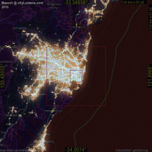
Analysis of Mascot night lights 2016
Square area 10x10 km:
 54.2%
54.2%90-99
33.04%80-89
2.62%70-79
4.9%60-69
2.97%50-59
2.27%40-49
0%30-39
0%20-29
0%10-19
0%0-9
0%Square area 50x50 km:
10.11%90-99
10.82%80-89
5.38%70-79
6.31%60-69
7.01%50-59
3.39%40-49
2.29%30-39
2.95%20-29
3.66%10-19
5.51%0-9
42.57%Clear (daylight) street map image can be seen on geolist.org.
Map coordinates:
33° 20' 26" South, 150° 29' 25.3" East
33° 55' 33.5" South, 151° 11' 36.5" East
34° 30' 26.6" South, 151° 53' 47.8" East
Some cities around Mascot sort by population:
• Kingsford
3.1 km =1.9 mi,  85°
85°
• Kensington
2.7 km =1.7 mi,  76°
76°
• Newtown
3.4 km =2.1 mi,  334°
334°
• Botany
2.2 km =1.4 mi,  174°
174°
• Zetland
2.5 km =1.6 mi,  34°
34°
• Alexandria
3 km =1.9 mi,  10°
10°
• Erskineville
2.7 km =1.7 mi,  344°
344°
• Eastlakes
1.8 km =1.1 mi,  111°
111°
2158538 (p: 15,985)
Sources (retrieved 2019-11-25):
» Earth at Night: Flat Maps 2012, 2016