Newtown night lights from space
Night Light of Newtown (New South Wales) from space (Australia) Src. Average luminocity for 10x10km area is 96.3322% and for 50x50km: 44.1496%.
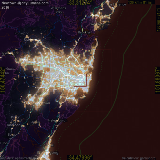
Analysis of Newtown night lights 2016
Square area 10x10 km:
 54.9%
54.9%90-99
30.94%80-89
8.57%70-79
4.72%60-69
0.87%50-59
0%40-49
0%30-39
0%20-29
0%10-19
0%0-9
0%Square area 50x50 km:
10.85%90-99
11.72%80-89
5.75%70-79
6.82%60-69
7.83%50-59
3.82%40-49
2.52%30-39
3.3%20-29
4.87%10-19
7.21%0-9
35.31%Clear (daylight) street map image can be seen on geolist.org.
Map coordinates:
33° 18' 45.9" South, 150° 28' 27.9" East
33° 53' 54.1" South, 151° 10' 39.1" East
34° 28' 47.9" South, 151° 52' 50.4" East
Some cities around Newtown sort by population:
• Glebe
2.3 km =1.4 mi,  15°
15°
• Camperdown
1 km =0.6 mi,  353°
353°
• Annandale
1.9 km =1.2 mi,  329°
329°
• Chippendale
2.2 km =1.4 mi,  54°
54°
• Alexandria
2 km =1.2 mi,  94°
94°
• Petersham
2.1 km =1.3 mi,  281°
281°
• Stanmore
1.3 km =0.8 mi,  291°
291°
• Erskineville
0.9 km =0.6 mi,  121°
121°
2155386 (p: 14,820)
Sources (retrieved 2019-11-25):
» Earth at Night: Flat Maps 2012, 2016