Hallam night lights from space
Night Light of Hallam (Victoria) from space (Australia) Src. Average luminocity for 10x10km area is 77.487% and for 50x50km: 35.9291%.
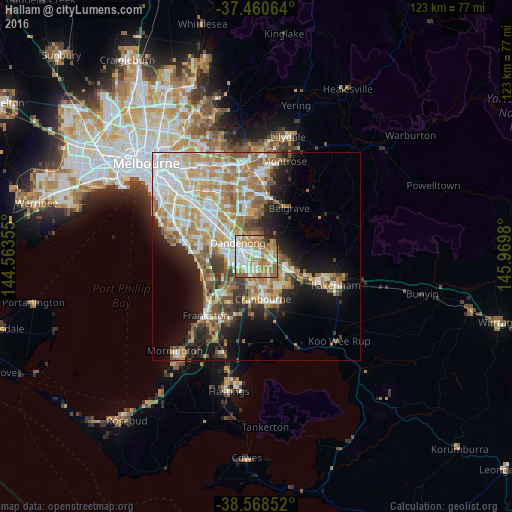
Analysis of Hallam night lights 2016
Square area 10x10 km:
 17.69%
90-99
21.27%80-89
8.12%70-79
14.94%60-69
19.48%50-59
12.34%40-49
1.3%30-39
1.46%20-29
2.6%10-19
0.81%0-9
0%Square area 50x50 km:
7.35%90-99
7.56%80-89
3.8%70-79
6.83%60-69
6.6%50-59
5.27%40-49
3.4%30-39
3.21%20-29
4.82%10-19
10.11%0-9
41.04%Clear (daylight) street map image can be seen on geolist.org.
Map coordinates:
37° 27' 38.3" South, 144° 33' 48.8" East
38° 1' 0" South, 145° 16' 0" East
38° 34' 6.7" South, 145° 58' 11.3" East
Some cities around Hallam sort by population:
• Dandenong
6.9 km =4.3 mi,  302°
302°
• Narre Warren South
3.8 km =2.4 mi,  143°
143°
• Narre Warren
3.5 km =2.2 mi,  122°
122°
• Hampton Park
2.4 km =1.5 mi,  218°
218°
• Endeavour Hills
4.5 km =2.8 mi,  350°
350°
• Doveton
3.5 km =2.2 mi,  316°
316°
• Lynbrook
4.5 km =2.8 mi,  191°
191°
• Narre Warren North
5.7 km =3.5 mi,  49°
49°
2164062 (p: 10,776)
Sources (retrieved 2019-11-25):
» Earth at Night: Flat Maps 2012, 2016