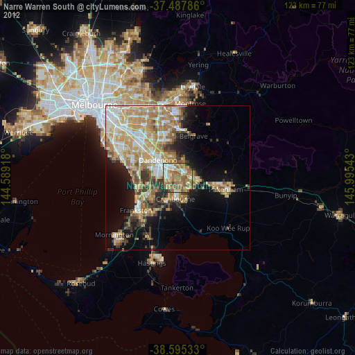
Narre Warren South night lights from space
Night Light of Narre Warren South (Victoria) from space (Australia) Src. Average luminocity for 10x10km area is 75.3864% and for 50x50km: 32.3555%.
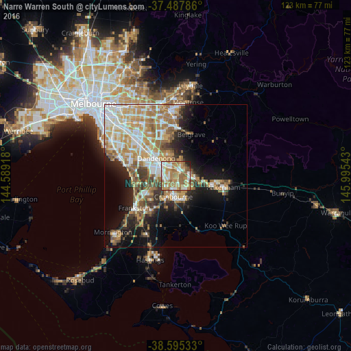
Analysis of Narre Warren South night lights 2016
Square area 10x10 km:
 14.45%
90-99
18.83%80-89
8.6%70-79
15.1%60-69
20.29%50-59
17.21%40-49
1.95%30-39
0.97%20-29
2.27%10-19
0.32%0-9
0%Square area 50x50 km:
6.16%90-99
6.58%80-89
3.43%70-79
6.25%60-69
6.07%50-59
4.7%40-49
3.35%30-39
3.13%20-29
4.6%10-19
10.55%0-9
45.18%Clear (daylight) street map image can be seen on geolist.org.
Map coordinates:
37° 29' 16.3" South, 144° 35' 21" East
38° 2' 37.3" South, 145° 17' 32.3" East
38° 35' 43.2" South, 145° 59' 43.5" East
Some cities around Narre Warren South sort by population:
• Berwick
5.2 km =3.2 mi,  77°
77°
• Hampton Park
3.9 km =2.4 mi,  287°
287°
• Cranbourne North
3.8 km =2.4 mi,  171°
171°
• Cranbourne West
6.3 km =3.9 mi,  200°
200°
• Hallam
3.8 km =2.4 mi,  323°
323°
• Doveton
7.3 km =4.5 mi, 320°
• Lynbrook
3.4 km =2.1 mi,  246°
246°
• Beaconsfield
6.5 km =4 mi,  96°
96°
9972518 (p: 30,132)
Sources (retrieved 2019-11-25):
» Earth at Night: Flat Maps 2012, 2016