Endeavour Hills night lights from space
Night Light of Endeavour Hills (Victoria) from space (Australia) Src. Average luminocity for 10x10km area is 65.599% and for 50x50km: 39.4879%.
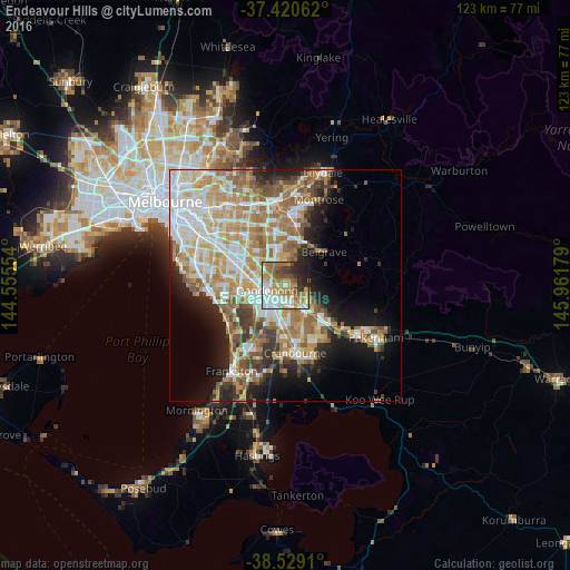
Analysis of Endeavour Hills night lights 2016
Square area 10x10 km:
 12.5%
12.5%90-99
14.61%80-89
5.84%70-79
13.15%60-69
17.53%50-59
9.42%40-49
6.49%30-39
4.38%20-29
11.2%10-19
4.87%0-9
0%Square area 50x50 km:
8.17%90-99
8.4%80-89
4.43%70-79
7.43%60-69
7.21%50-59
5.84%40-49
3.84%30-39
3.57%20-29
5.15%10-19
9.27%0-9
36.69%Clear (daylight) street map image can be seen on geolist.org.
Map coordinates:
37° 25' 14.2" South, 144° 33' 19.9" East
37° 58' 37" South, 145° 15' 31.2" East
38° 31' 44.8" South, 145° 57' 42.4" East
Some cities around Endeavour Hills sort by population:
• Rowville
5.3 km =3.3 mi,  335°
335°
• Dandenong
5.2 km =3.2 mi,  262°
262°
• Hampton Park
6.3 km =3.9 mi,  186°
186°
• Dandenong North
4.6 km =2.9 mi,  284°
284°
• Hallam
4.5 km =2.8 mi,  170°
170°
• Doveton
2.5 km =1.6 mi,  223°
223°
• Narre Warren North
5.1 km =3.2 mi,  97°
97°
• Lysterfield
6.1 km =3.8 mi,  36°
36°
8347325 (p: 24,116)
Sources (retrieved 2019-11-25):
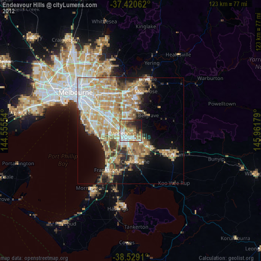
» Earth at Night: Flat Maps 2012, 2016