Gordon night lights from space
Night Light of Gordon (New South Wales) from space (Australia) Src. Average luminocity for 10x10km area is 70.13% and for 50x50km: 43.1196%.
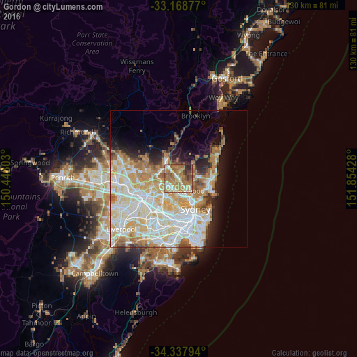
Analysis of Gordon night lights 2016
Square area 10x10 km:
 6.96%
6.96%90-99
13.55%80-89
7.14%70-79
15.57%60-69
34.43%50-59
10.62%40-49
4.95%30-39
4.03%20-29
2.75%10-19
0%0-9
0%Square area 50x50 km:
10.97%90-99
12%80-89
6.25%70-79
6.8%60-69
6.94%50-59
3.15%40-49
1.95%30-39
2.4%20-29
3.56%10-19
6.32%0-9
39.67%Clear (daylight) street map image can be seen on geolist.org.
Map coordinates:
33° 10' 7.6" South, 150° 26' 52.9" East
33° 45' 19.3" South, 151° 9' 4.1" East
34° 20' 16.6" South, 151° 51' 15.4" East
Some cities around Gordon sort by population:
• Saint Ives
3 km =1.9 mi,  15°
15°
• Turramurra
3.2 km =2 mi,  319°
319°
• Pymble
1.5 km =0.9 mi,  326°
326°
• Killara
1.6 km =1 mi,  139°
139°
• Roseville
4.3 km =2.7 mi, 136°
• Lindfield
3.4 km =2.1 mi,  155°
155°
• Macquarie Park
3.6 km =2.2 mi,  217°
217°
• West Pymble
2.1 km =1.3 mi,  232°
232°
2164903 (p: 7,567)
Sources (retrieved 2019-11-25):
» Earth at Night: Flat Maps 2012, 2016