Roseville night lights from space
Night Light of Roseville (New South Wales) from space (Australia) Src. Average luminocity for 10x10km area is 73.022% and for 50x50km: 41.3584%.
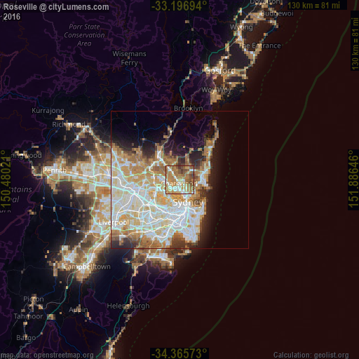
Analysis of Roseville night lights 2016
Square area 10x10 km:
 8.97%
8.97%90-99
14.84%80-89
8.06%70-79
18.68%60-69
30.59%50-59
10.99%40-49
5.49%30-39
2.38%20-29
0%10-19
0%0-9
0%Square area 50x50 km:
10.28%90-99
11.16%80-89
5.38%70-79
6.46%60-69
7.21%50-59
3.39%40-49
2.03%30-39
3.01%20-29
4.35%10-19
6.47%0-9
40.25%Clear (daylight) street map image can be seen on geolist.org.
Map coordinates:
33° 11' 49" South, 150° 28' 48.8" East
33° 46' 60" South, 151° 10' 60" East
34° 21' 56.6" South, 151° 53' 11.3" East
Some cities around Roseville sort by population:
• Chatswood
1.9 km =1.2 mi,  180°
180°
• Lane Cove North
2.9 km =1.8 mi,  212°
212°
• Lane Cove
3.9 km =2.4 mi,  203°
203°
• Killara
2.7 km =1.7 mi,  314°
314°
• Lindfield
1.5 km =0.9 mi,  270°
270°
• Artarmon
3.7 km =2.3 mi, 180°
• Forestville
3 km =1.9 mi,  51°
51°
• Willoughby
2.8 km =1.7 mi,  148°
148°
2151061 (p: 9,908)
Sources (retrieved 2019-11-25):
» Earth at Night: Flat Maps 2012, 2016