Rowville night lights from space
Night Light of Rowville (Victoria) from space (Australia) Src. Average luminocity for 10x10km area is 68.0292% and for 50x50km: 42.9812%.
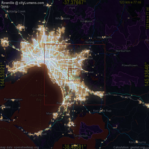
Analysis of Rowville night lights 2016
Square area 10x10 km:
 10.55%
90-99
11.69%80-89
6.82%70-79
12.01%60-69
23.21%50-59
18.83%40-49
8.28%30-39
3.9%20-29
4.71%10-19
0%0-9
0%Square area 50x50 km:
9.53%90-99
9.39%80-89
5.06%70-79
7.82%60-69
7.44%50-59
6.01%40-49
4.1%30-39
3.58%20-29
5.09%10-19
9.61%0-9
32.39%Clear (daylight) street map image can be seen on geolist.org.
Map coordinates:
37° 22' 36" South, 144° 31' 48.8" East
37° 55' 60" South, 145° 13' 60" East
38° 29' 8.9" South, 145° 56' 11.3" East
Some cities around Rowville sort by population:
• Endeavour Hills
5.3 km =3.3 mi,  155°
155°
• Dandenong North
4.3 km =2.7 mi,  210°
210°
• Wheelers Hill
5.7 km =3.5 mi,  310°
310°
• Wantirna South
5.7 km =3.5 mi,  345°
345°
• Mulgrave
5 km =3.1 mi,  276°
276°
• Noble Park North
4 km =2.5 mi,  242°
242°
• Knoxfield
5 km =3.1 mi,  16°
16°
• Scoresby
3.7 km =2.3 mi,  0°
0°
2150894 (p: 33,160)
Sources (retrieved 2019-11-25):
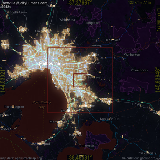
» Earth at Night: Flat Maps 2012, 2016