Dandenong North night lights from space
Night Light of Dandenong North (Victoria) from space (Australia) Src. Average luminocity for 10x10km area is 80.6753% and for 50x50km: 42.4644%.
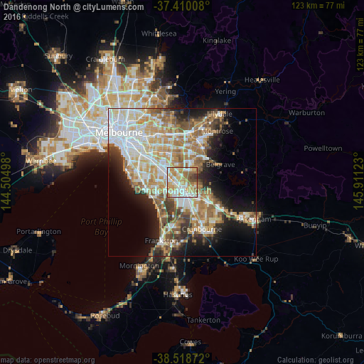

Analysis of Dandenong North night lights 2016
Square area 10x10 km:
 19.32%
90-99
22.4%80-89
10.55%70-79
19.32%60-69
16.56%50-59
6.82%40-49
3.41%30-39
1.62%20-29
0%10-19
0%0-9
0%Square area 50x50 km:
9.94%90-99
9.06%80-89
4.65%70-79
7.41%60-69
7.23%50-59
6%40-49
4.05%30-39
3.81%20-29
5.46%10-19
9.84%0-9
32.54%Clear (daylight) street map image can be seen on geolist.org.
Map coordinates:
37° 24' 36.3" South, 144° 30' 17.9" East
37° 57' 59.4" South, 145° 12' 29.2" East
38° 31' 7.4" South, 145° 54' 40.4" East
Some cities around Dandenong North sort by population:
• Rowville
4.3 km =2.7 mi,  30°
30°
• Noble Park
3.6 km =2.2 mi,  269°
269°
• Keysborough
4.1 km =2.5 mi,  227°
227°
• Endeavour Hills
4.6 km =2.9 mi,  104°
104°
• Mulgrave
5 km =3.1 mi,  327°
327°
• Springvale South
5.1 km =3.2 mi, 269°
• Doveton
4 km =2.5 mi,  137°
137°
• Noble Park North
2.3 km =1.4 mi,  323°
323°
9972522 (p: 22,225)
Sources (retrieved 2019-11-25):
» Earth at Night: Flat Maps 2012, 2016