Camperdown night lights from space
Night Light of Camperdown (New South Wales) from space (Australia) Src. Average luminocity for 10x10km area is 95.1696% and for 50x50km: 44.4794%.
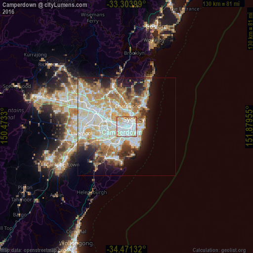
Analysis of Camperdown night lights 2016
Square area 10x10 km:
 52.45%
90-99
28.67%80-89
9.09%70-79
7.69%60-69
1.92%50-59
0.17%40-49
0%30-39
0%20-29
0%10-19
0%0-9
0%Square area 50x50 km:
10.85%90-99
11.72%80-89
5.75%70-79
6.82%60-69
7.93%50-59
3.95%40-49
2.56%30-39
3.38%20-29
5%10-19
7.95%0-9
34.08%Clear (daylight) street map image can be seen on geolist.org.
Map coordinates:
33° 18' 14.4" South, 150° 28' 23.9" East
33° 53' 22.7" South, 151° 10' 35.1" East
34° 28' 16.8" South, 151° 52' 46.4" East
Some cities around Camperdown sort by population:
• Newtown
1 km =0.6 mi,  173°
173°
• Leichhardt
2 km =1.2 mi,  290°
290°
• Glebe
1.4 km =0.9 mi,  31°
31°
• Annandale
1.1 km =0.7 mi,  307°
307°
• Chippendale
2 km =1.2 mi,  80°
80°
• Stanmore
1.2 km =0.7 mi,  246°
246°
• Erskineville
1.7 km =1.1 mi,  148°
148°
• Lilyfield
1.9 km =1.2 mi,  327°
327°
2172563 (p: 11,336)
Sources (retrieved 2019-11-25):
» Earth at Night: Flat Maps 2012, 2016