Annandale night lights from space
Night Light of Annandale (New South Wales) from space (Australia) Src. Average luminocity for 10x10km area is 93.979% and for 50x50km: 46.2367%.
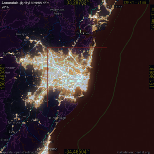
Analysis of Annandale night lights 2016
Square area 10x10 km:
 49.48%
90-99
26.05%80-89
10.66%70-79
12.41%60-69
1.4%50-59
0%40-49
0%30-39
0%20-29
0%10-19
0%0-9
0%Square area 50x50 km:
11.18%90-99
12.12%80-89
6.15%70-79
7.08%60-69
8.17%50-59
4.12%40-49
2.62%30-39
3.55%20-29
5.24%10-19
8.76%0-9
31.01%Clear (daylight) street map image can be seen on geolist.org.
Map coordinates:
33° 17' 51.4" South, 150° 27' 48.8" East
33° 52' 60" South, 151° 10' 0" East
34° 27' 54.1" South, 151° 52' 11.3" East
Some cities around Annandale sort by population:
• Newtown
1.9 km =1.2 mi,  149°
149°
• Leichhardt
1 km =0.6 mi,  269°
269°
• Glebe
1.7 km =1.1 mi,  72°
72°
• Camperdown
1.1 km =0.7 mi,  127°
127°
• Petersham
1.7 km =1.1 mi,  220°
220°
• Stanmore
1.2 km =0.7 mi,  190°
190°
• Lilyfield
0.9 km =0.6 mi,  352°
352°
• Haberfield
2.1 km =1.3 mi, 271°
2177854 (p: 9,259)
Sources (retrieved 2019-11-25):
» Earth at Night: Flat Maps 2012, 2016