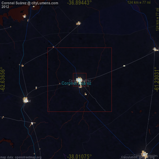
Coronel Suárez night lights from space
Night Light of Coronel Suárez (Buenos Aires) from space (Argentina) Src. Average luminocity for 10x10km area is 25.7727% and for 50x50km: 1.4769%.
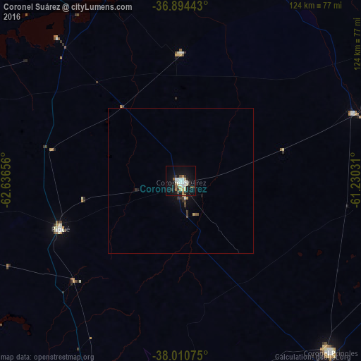
Analysis of Coronel Suárez night lights 2016
Square area 10x10 km:
 3.9%
3.9%90-99
6.17%80-89
4.22%70-79
1.46%60-69
1.79%50-59
1.95%40-49
2.6%30-39
3.73%20-29
2.76%10-19
28.57%0-9
42.86%Square area 50x50 km:
0.18%90-99
0.27%80-89
0.21%70-79
0.11%60-69
0.07%50-59
0.14%40-49
0.16%30-39
0.4%20-29
0.14%10-19
1.48%0-9
96.83%Clear (daylight) street map image can be seen on geolist.org.
Map coordinates:
36° 53' 39.9" South, 62° 38' 11.6" West
37° 27' 16.8" South, 61° 56' 0.3" West
38° 0' 38.7" South, 61° 13' 49.1" West
Some cities around Coronel Suárez sort by population:
• Bahía Blanca
143.7 km =89.3 mi,  191°
191°
• Santa Rosa
228.4 km =141.9 mi,  294°
294°
• Olavarría
155.8 km =96.8 mi,  66°
66°
• Punta Alta
158.5 km =98.5 mi,  184°
184°
• Azul
198.8 km =123.5 mi, 67°
• Tres Arroyos
177.4 km =110.2 mi,  125°
125°
• General Acha
236 km =146.6 mi,  272°
272°
• Guatraché
142.7 km =88.7 mi,  260°
260°
3860164 (p: 27,000)
Sources (retrieved 2019-11-25):
» Earth at Night: Flat Maps 2012, 2016