General Acha night lights from space
Night Light of General Acha (La Pampa) from space (Argentina) Src. Average luminocity for 10x10km area is 9.2403% and for 50x50km: 0.4072%.
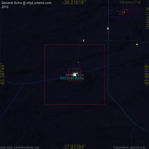
Analysis of General Acha night lights 2016
Square area 10x10 km:
 1.62%
1.62%90-99
1.62%80-89
0.97%70-79
1.62%60-69
0.81%50-59
0.49%40-49
0.97%30-39
1.62%20-29
0.65%10-19
0%0-9
89.61%Square area 50x50 km:
0.07%90-99
0.07%80-89
0.04%70-79
0.07%60-69
0.03%50-59
0.02%40-49
0.04%30-39
0.1%20-29
0.03%10-19
0%0-9
99.54%Clear (daylight) street map image can be seen on geolist.org.
Map coordinates:
36° 48' 58.2" South, 65° 18' 26.8" West
37° 22' 37.1" South, 64° 36' 15.5" West
37° 56' 1.1" South, 63° 54' 4.3" West
Some cities around General Acha sort by population:
• Santa Rosa
89.2 km =55.4 mi,  18°
18°
• Coronel Suárez
236 km =146.6 mi,  92°
92°
• Eduardo Castex
164.9 km =102.5 mi,  9°
9°
• Choele Choel
231.7 km =144 mi,  203°
203°
• Lamarque
246.8 km =153.4 mi, 202°
• Victorica
148.9 km =92.5 mi,  330°
330°
• Fray Luis Beltrán
237.8 km =147.8 mi,  205°
205°
• Guatraché
100.1 km =62.2 mi,  108°
108°
3855143 (p: 12,536)
Sources (retrieved 2019-11-25):
» Earth at Night: Flat Maps 2012, 2016