Olavarría night lights from space
Night Light of Olavarría (Buenos Aires) from space (Argentina) Src. Average luminocity for 10x10km area is 50.9627% and for 50x50km: 4.8605%.
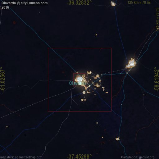
Analysis of Olavarría night lights 2016
Square area 10x10 km:
 10.06%
90-99
11.53%80-89
7.63%70-79
6.01%60-69
7.14%50-59
6.33%40-49
2.76%30-39
6.98%20-29
16.56%10-19
20.45%0-9
4.55%Square area 50x50 km:
0.44%90-99
0.59%80-89
0.91%70-79
0.46%60-69
0.69%50-59
0.74%40-49
0.34%30-39
0.89%20-29
1.38%10-19
4.19%0-9
89.41%Clear (daylight) street map image can be seen on geolist.org.
Map coordinates:
36° 19' 42" South, 61° 1' 32.4" West
36° 53' 33.8" South, 60° 19' 21.1" West
37° 27' 10.7" South, 59° 37' 9.9" West
Some cities around Olavarría sort by population:
• Tandil
115.7 km =71.9 mi,  114°
114°
• Azul
43.3 km =26.9 mi,  72°
72°
• Tres Arroyos
164.7 km =102.3 mi,  178°
178°
• Balcarce
211.2 km =131.2 mi,  120°
120°
• Nueve de Julio
168.7 km =104.8 mi,  342°
342°
• Coronel Suárez
155.8 km =96.8 mi,  246°
246°
• Veinticinco de Mayo
162.9 km =101.2 mi,  4°
4°
• Coronel Dorrego
220 km =136.7 mi,  202°
202°
3842670 (p: 86,320)
Sources (retrieved 2019-11-25):
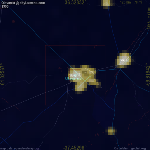
» NASA, Earths city lights 1995
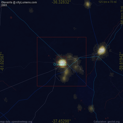
» NASA city lights 2003
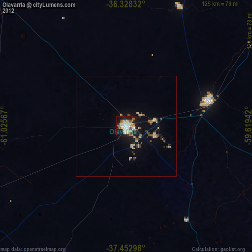
» Earth at Night: Flat Maps 2012, 2016