Huambo night lights from space
Night Light of Huambo from space (Angola) Src. Average luminocity for 10x10km area is 53.1407% and for 50x50km: 3.4967%.
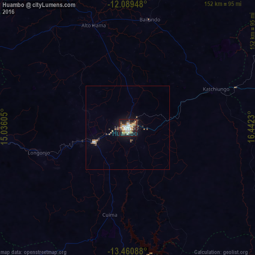
Analysis of Huambo night lights 2016
Square area 10x10 km:
 10.82%
90-99
9.96%80-89
3.03%70-79
16.02%60-69
5.41%50-59
4.98%40-49
4.55%30-39
8.44%20-29
14.07%10-19
22.51%0-9
0.22%Square area 50x50 km:
0.45%90-99
0.47%80-89
0.15%70-79
0.82%60-69
0.39%50-59
0.49%40-49
0.42%30-39
0.45%20-29
0.66%10-19
2.98%0-9
92.71%Clear (daylight) street map image can be seen on geolist.org.
Map coordinates:
12° 5' 22.1" South, 15° 2' 9.8" East
12° 46' 34" South, 15° 44' 21" East
13° 27' 39.2" South, 16° 26' 32.3" East
Some cities around Huambo sort by population:
• Cuito
136.8 km =85 mi,  71°
71°
• Longonjo
54.6 km =33.9 mi,  254°
254°
• Caála
21.1 km =13.1 mi, 246°
• Catabola
181.5 km =112.8 mi, 67°
• Uacu Cungo
171.7 km =106.7 mi,  336°
336°
• Caconda
128.9 km =80.1 mi,  214°
214°
• Chissamba
185.9 km =115.5 mi, 68°
• Chela
62.2 km =38.6 mi,  327°
327°
3348313 (p: 226,145)
Sources (retrieved 2019-11-25):
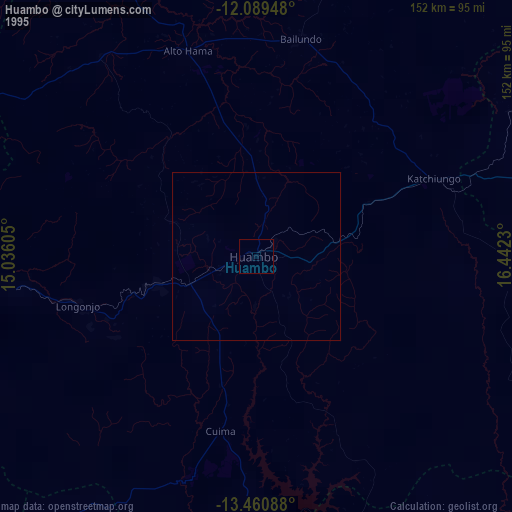
» NASA, Earths city lights 1995
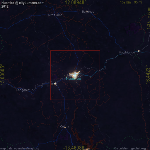
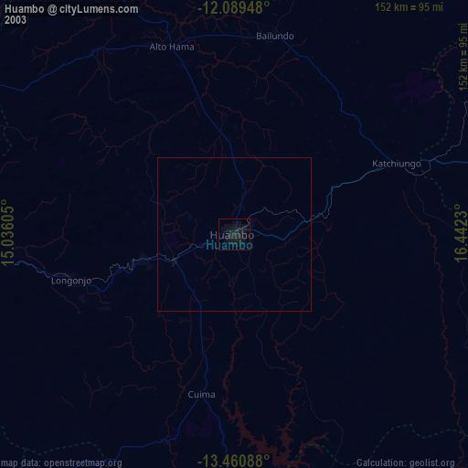
» NASA city lights 2003
» Earth at Night: Flat Maps 2012, 2016