Shurugwi night lights from space
Night Light of Shurugwi (Midlands) from space (Zimbabwe) Src. Average luminocity for 10x10km area is 3.5558% and for 50x50km: 1.7345%.
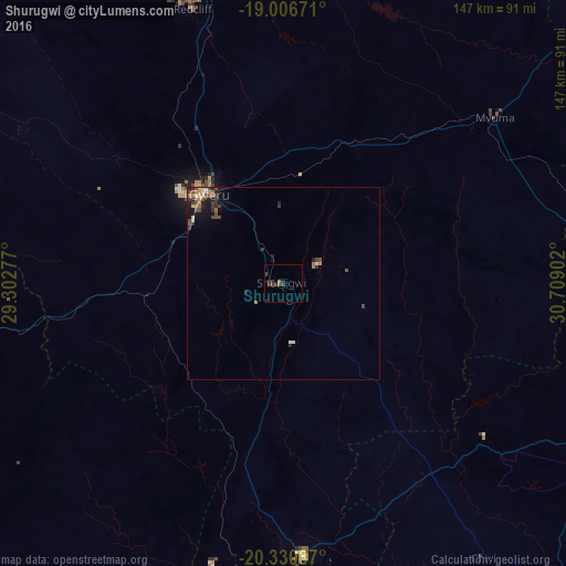
Analysis of Shurugwi night lights 2016
Square area 10x10 km:
 0%
0%90-99
0%80-89
0%70-79
0%60-69
0.41%50-59
1.24%40-49
1.65%30-39
3.72%20-29
1.24%10-19
0%0-9
91.74%Square area 50x50 km:
0.04%90-99
0.12%80-89
0.26%70-79
0.2%60-69
0.3%50-59
0.28%40-49
0.7%30-39
0.48%20-29
0.41%10-19
0.98%0-9
96.23%Clear (daylight) street map image can be seen on geolist.org.
Map coordinates:
19° 0' 24.2" South, 29° 18' 10" East
19° 40' 12.6" South, 30° 0' 21.2" East
20° 19' 51.1" South, 30° 42' 32.5" East
Some cities around Shurugwi sort by population:
• Gweru
31.5 km =19.6 mi,  320°
320°
• Kwekwe
84.9 km =52.8 mi,  346°
346°
• Masvingo
96.4 km =59.9 mi,  116°
116°
• Zvishavane
73.3 km =45.5 mi,  175°
175°
• Redcliff
74.6 km =46.4 mi,  341°
341°
• Mashava
64.4 km =40 mi,  129°
129°
• Chivhu
117.7 km =73.1 mi,  52°
52°
• Inyati
121.4 km =75.4 mi,  269°
269°
881164 (p: 17,075)
Sources (retrieved 2019-11-25):
» Earth at Night: Flat Maps 2012, 2016