Kwekwe night lights from space
Night Light of Kwekwe (Midlands) from space (Zimbabwe) Src. Average luminocity for 10x10km area is 39.1948% and for 50x50km: 2.3543%.
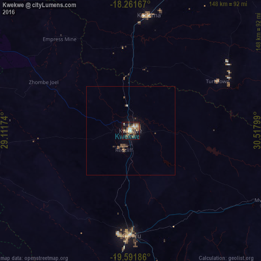
Analysis of Kwekwe night lights 2016
Square area 10x10 km:
 4.33%
4.33%90-99
5.19%80-89
3.03%70-79
3.46%60-69
8.87%50-59
9.52%40-49
10.39%30-39
7.14%20-29
6.71%10-19
30.95%0-9
10.39%Square area 50x50 km:
0.18%90-99
0.21%80-89
0.11%70-79
0.13%60-69
0.43%50-59
0.66%40-49
0.63%30-39
0.5%20-29
0.34%10-19
1.86%0-9
94.93%Clear (daylight) street map image can be seen on geolist.org.
Map coordinates:
18° 15' 42" South, 29° 6' 42.3" East
18° 55' 41.1" South, 29° 48' 53.5" East
19° 35' 30.7" South, 30° 31' 4.8" East
Some cities around Kwekwe sort by population:
• Gweru
58 km =36 mi,  179°
179°
• Kadoma
67 km =41.6 mi,  9°
9°
• Chegutu
95.1 km =59.1 mi,  21°
21°
• Redcliff
12.2 km =7.6 mi,  195°
195°
• Gokwe
122.8 km =76.3 mi,  310°
310°
• Shurugwi
84.9 km =52.8 mi,  166°
166°
• Chivhu
113.7 km =70.6 mi,  95°
95°
• Chakari
96.5 km =60 mi,  4°
4°
888710 (p: 99,149)
Sources (retrieved 2019-11-25):
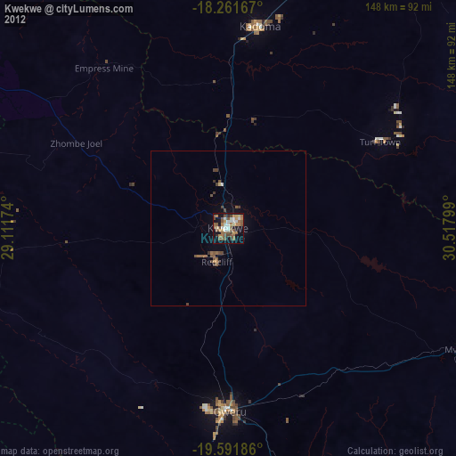
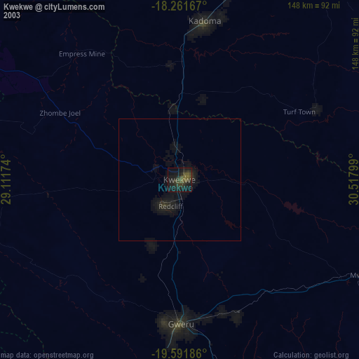
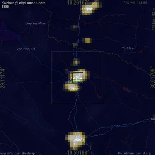
» NASA, Earths city lights 1995
» NASA city lights 2003
» Earth at Night: Flat Maps 2012, 2016