Harare night lights from space
Night Light of Harare from space (Zimbabwe) Src. Average luminocity for 10x10km area is 94.3571% and for 50x50km: 27.5102%.
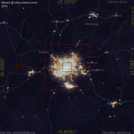


Analysis of Harare night lights 2016
Square area 10x10 km:
 39.18%
90-99
36.58%80-89
13.42%70-79
9.74%60-69
1.08%50-59
0%40-49
0%30-39
0%20-29
0%10-19
0%0-9
0%Square area 50x50 km:
5.19%90-99
5.45%80-89
2.49%70-79
4.61%60-69
4.07%50-59
3.47%40-49
4.46%30-39
4.03%20-29
6.06%10-19
9.68%0-9
50.5%Clear (daylight) street map image can be seen on geolist.org.
Map coordinates:
17° 9' 25.6" South, 30° 21' 0.9" East
17° 49' 39.8" South, 31° 3' 12.1" East
18° 29' 44.9" South, 31° 45' 23.4" East
Some cities around Harare sort by population:
• Chitungwiza
20.7 km =12.9 mi,  173°
173°
• Epworth
12.1 km =7.5 mi,  124°
124°
• Marondera
66 km =41 mi,  127°
127°
• Norton
37.9 km =23.5 mi,  260°
260°
• Bindura
65.4 km =40.6 mi,  26°
26°
• Ruwa
21.4 km =13.3 mi,  108°
108°
• Mazowe
37 km =23 mi,  346°
346°
• Glendale
52.6 km =32.7 mi,  1°
1°
890299 (p: 1,542,813)
Sources (retrieved 2019-11-25):
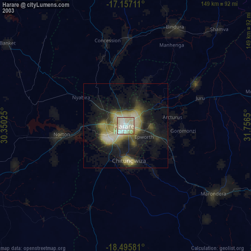
» NASA, Earths city lights 1995
» NASA city lights 2003
» Earth at Night: Flat Maps 2012, 2016