Ruwa night lights from space
Night Light of Ruwa (Mashonaland East) from space (Zimbabwe) Src. Average luminocity for 10x10km area is 27.1212% and for 50x50km: 19.1501%.
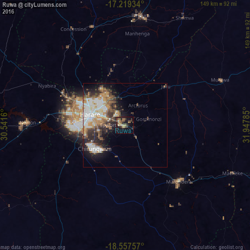
Analysis of Ruwa night lights 2016
Square area 10x10 km:
 1.08%
1.08%90-99
2.16%80-89
2.81%70-79
4.11%60-69
6.93%50-59
3.68%40-49
5.41%30-39
8.23%20-29
8.23%10-19
20.56%0-9
36.8%Square area 50x50 km:
3.84%90-99
3.84%80-89
1.66%70-79
2.96%60-69
2.34%50-59
2.71%40-49
3.21%30-39
2.94%20-29
4.24%10-19
6.98%0-9
65.29%Clear (daylight) street map image can be seen on geolist.org.
Map coordinates:
17° 13' 9.6" South, 30° 32' 29.8" East
17° 53' 23" South, 31° 14' 41" East
18° 33' 27.3" South, 31° 56' 52.3" East
Some cities around Ruwa sort by population:
• Harare
21.4 km =13.3 mi,  288°
288°
• Chitungwiza
22.5 km =14 mi,  232°
232°
• Epworth
10.3 km =6.4 mi,  269°
269°
• Marondera
46.2 km =28.7 mi,  135°
135°
• Norton
57.6 km =35.8 mi, 270°
• Mazowe
51.6 km =32.1 mi,  326°
326°
• Glendale
62.3 km =38.7 mi,  342°
342°
• Murehwa
63.3 km =39.3 mi,  64°
64°
882009 (p: 30,000)
Sources (retrieved 2019-11-25):
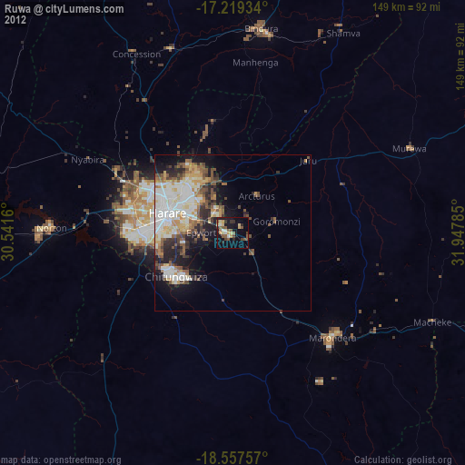
» Earth at Night: Flat Maps 2012, 2016