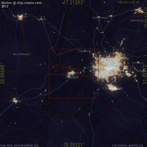
Norton night lights from space
Night Light of Norton (Mashonaland West) from space (Zimbabwe) Src. Average luminocity for 10x10km area is 17.1515% and for 50x50km: 3.9704%.

Analysis of Norton night lights 2016
Square area 10x10 km:
 0%
0%90-99
0.65%80-89
1.52%70-79
2.38%60-69
4.98%50-59
5.19%40-49
6.49%30-39
2.38%20-29
2.38%10-19
3.9%0-9
70.13%Square area 50x50 km:
0.34%90-99
0.33%80-89
0.3%70-79
0.43%60-69
0.76%50-59
0.71%40-49
1.21%30-39
0.85%20-29
1.14%10-19
2.5%0-9
91.43%Clear (daylight) street map image can be seen on geolist.org.
Map coordinates:
17° 12' 46.5" South, 29° 59' 48.8" East
17° 52' 60" South, 30° 42' 0" East
18° 33' 4.4" South, 31° 24' 11.3" East
Some cities around Norton sort by population:
• Harare
37.9 km =23.5 mi,  80°
80°
• Chitungwiza
42.3 km =26.3 mi,  109°
109°
• Epworth
47.4 km =29.5 mi,  90°
90°
• Chegutu
65.2 km =40.5 mi,  245°
245°
• Ruwa
57.6 km =35.8 mi, 90°
• Mazowe
51.2 km =31.8 mi,  34°
34°
• Glendale
70.4 km =43.7 mi, 33°
• Banket
64 km =39.8 mi,  330°
330°
884141 (p: 52,054)
Sources (retrieved 2019-11-25):
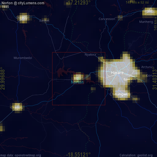
» NASA, Earths city lights 1995
» NASA city lights 2003
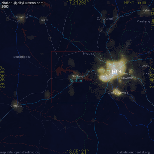
» Earth at Night: Flat Maps 2012, 2016