Ndola night lights from space
Night Light of Ndola (Copperbelt) from space (Zambia) Src. Average luminocity for 10x10km area is 74.2489% and for 50x50km: 8.6691%.
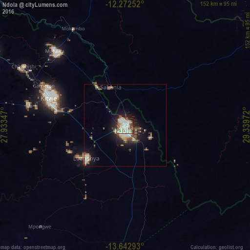
Analysis of Ndola night lights 2016
Square area 10x10 km:
 19.7%
19.7%90-99
22.94%80-89
8.66%70-79
9.52%60-69
7.79%50-59
11.69%40-49
7.14%30-39
4.98%20-29
4.98%10-19
2.6%0-9
0%Square area 50x50 km:
1.33%90-99
1.61%80-89
0.65%70-79
1.22%60-69
0.99%50-59
1.35%40-49
1.5%30-39
1.22%20-29
1.89%10-19
5.53%0-9
82.72%Clear (daylight) street map image can be seen on geolist.org.
Map coordinates:
12° 16' 21.1" South, 27° 56' 0.5" East
12° 57' 31.2" South, 28° 38' 11.7" East
13° 38' 34.5" South, 29° 20' 23" East
Some cities around Ndola sort by population:
• Kitwe
49.1 km =30.5 mi,  290°
290°
• Chingola
94.6 km =58.8 mi,  300°
300°
• Mufulira
62.5 km =38.8 mi,  316°
316°
• Luanshya
31 km =19.3 mi,  230°
230°
• Kalulushi
60.1 km =37.3 mi,  282°
282°
• Mkushi
110.1 km =68.4 mi,  131°
131°
• Chambishi
72.9 km =45.3 mi, 299°
• Mpongwe
80.4 km =50 mi,  220°
220°
901344 (p: 394,518)
Sources (retrieved 2019-11-25):
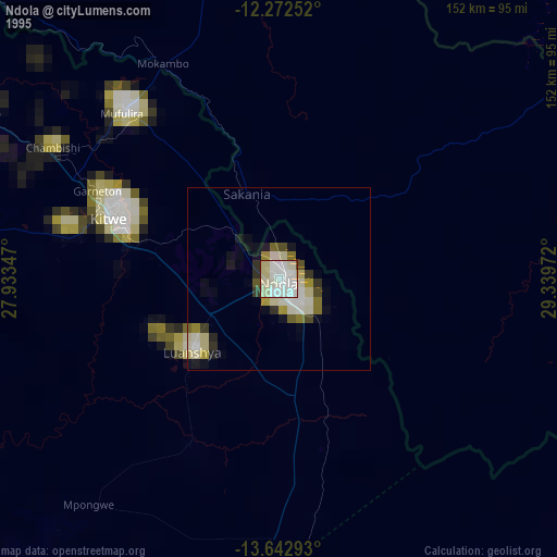
» NASA, Earths city lights 1995
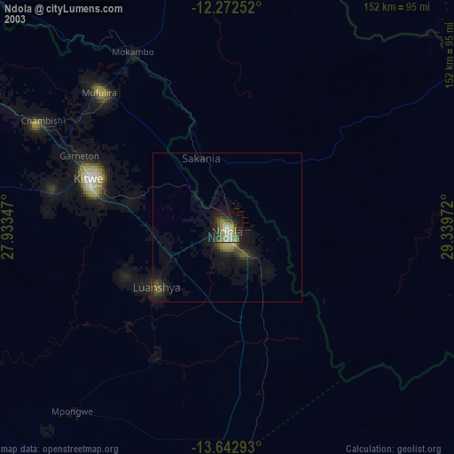
» NASA city lights 2003
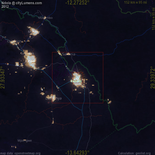
» Earth at Night: Flat Maps 2012, 2016