Mufulira night lights from space
Night Light of Mufulira (Copperbelt) from space (Zambia) Src. Average luminocity for 10x10km area is 44.6472% and for 50x50km: 5.2699%.
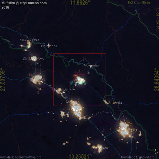
Analysis of Mufulira night lights 2016
Square area 10x10 km:
 3.9%
3.9%90-99
17.1%80-89
3.9%70-79
3.46%60-69
9.09%50-59
3.46%40-49
5.19%30-39
1.52%20-29
9.31%10-19
39.61%0-9
3.46%Square area 50x50 km:
0.45%90-99
0.99%80-89
0.37%70-79
0.36%60-69
0.84%50-59
0.75%40-49
1.14%30-39
0.52%20-29
1.21%10-19
4.68%0-9
88.7%Clear (daylight) street map image can be seen on geolist.org.
Map coordinates:
11° 51' 45.4" South, 27° 32' 15.3" East
12° 32' 59.4" South, 28° 14' 26.6" East
13° 14' 6.8" South, 28° 56' 37.8" East
Some cities around Mufulira sort by population:
• Kitwe
28.2 km =17.5 mi,  186°
186°
• Ndola
62.5 km =38.8 mi,  136°
136°
• Chingola
38.8 km =24.1 mi,  273°
273°
• Luanshya
68 km =42.3 mi,  163°
163°
• Kalulushi
36.1 km =22.4 mi,  206°
206°
• Chililabombwe
49.8 km =30.9 mi,  294°
294°
• Chambishi
22.3 km =13.9 mi,  245°
245°
• Mpongwe
107.1 km =66.5 mi,  184°
184°
905395 (p: 120,500)
Sources (retrieved 2019-11-25):
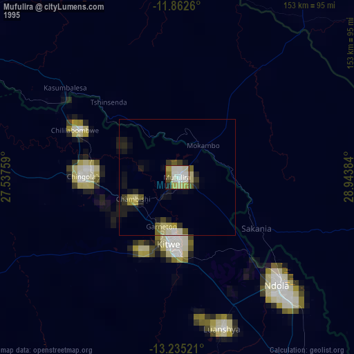
» NASA, Earths city lights 1995
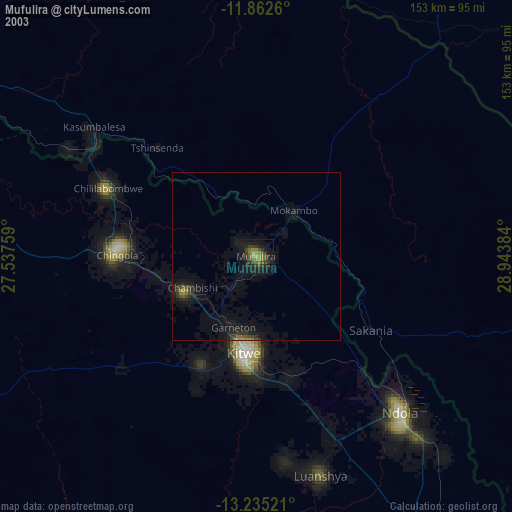
» NASA city lights 2003
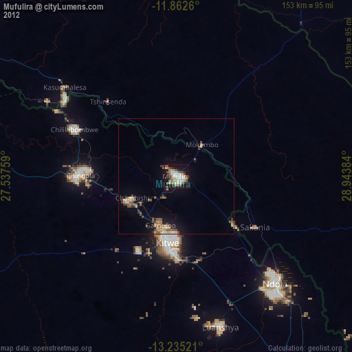
» Earth at Night: Flat Maps 2012, 2016