Luanshya night lights from space
Night Light of Luanshya (Copperbelt) from space (Zambia) Src. Average luminocity for 10x10km area is 35.8095% and for 50x50km: 5.9616%.
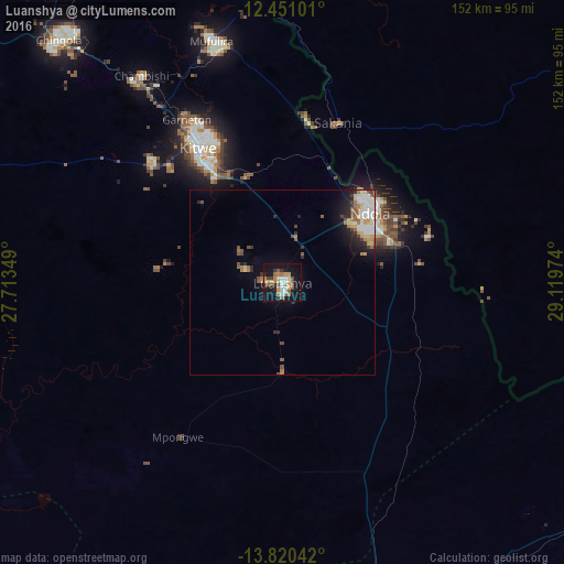
Analysis of Luanshya night lights 2016
Square area 10x10 km:
 3.9%
3.9%90-99
6.71%80-89
4.11%70-79
4.11%60-69
8.66%50-59
6.71%40-49
2.81%30-39
4.55%20-29
3.03%10-19
41.77%0-9
13.64%Square area 50x50 km:
0.88%90-99
1.05%80-89
0.66%70-79
0.68%60-69
1.03%50-59
0.85%40-49
0.73%30-39
0.58%20-29
1.12%10-19
3.75%0-9
88.67%Clear (daylight) street map image can be seen on geolist.org.
Map coordinates:
12° 27' 3.6" South, 27° 42' 48.6" East
13° 8' 12" South, 28° 24' 59.8" East
13° 49' 13.5" South, 29° 7' 11.1" East
Some cities around Luanshya sort by population:
• Kitwe
43.2 km =26.8 mi,  329°
329°
• Ndola
31 km =19.3 mi,  50°
50°
• Chingola
88.9 km =55.2 mi,  319°
319°
• Mufulira
68 km =42.3 mi,  343°
343°
• Kalulushi
47.9 km =29.8 mi,  313°
313°
• Kapiri Mposhi
96.8 km =60.1 mi,  163°
163°
• Chambishi
68.5 km =42.6 mi, 324°
• Mpongwe
50.2 km =31.2 mi,  214°
214°
909863 (p: 113,365)
Sources (retrieved 2019-11-25):
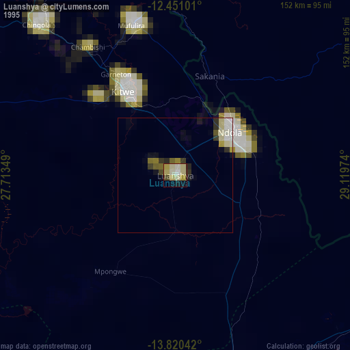
» NASA, Earths city lights 1995
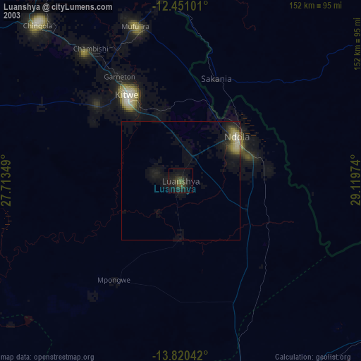
» NASA city lights 2003
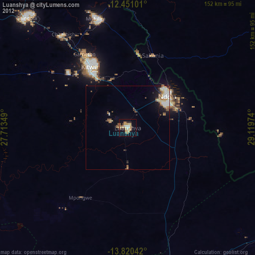
» Earth at Night: Flat Maps 2012, 2016