Mpongwe night lights from space
Night Light of Mpongwe (Copperbelt) from space (Zambia) Src. Average luminocity for 10x10km area is 1.1963% and for 50x50km: 0.079%.
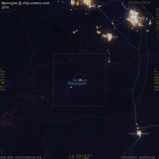
Analysis of Mpongwe night lights 2016
Square area 10x10 km:
 0%
0%90-99
0%80-89
0%70-79
0%60-69
0%50-59
0%40-49
1.24%30-39
0.41%20-29
1.65%10-19
0%0-9
96.69%Square area 50x50 km:
0%90-99
0%80-89
0%70-79
0%60-69
0%50-59
0%40-49
0.12%30-39
0.02%20-29
0.07%10-19
0%0-9
99.8%Clear (daylight) street map image can be seen on geolist.org.
Map coordinates:
12° 49' 28.2" South, 27° 27' 6.9" East
13° 30' 32.9" South, 28° 9' 18.1" East
14° 11' 30.6" South, 28° 51' 29.4" East
Some cities around Mpongwe sort by population:
• Kitwe
78.8 km =49 mi,  4°
4°
• Ndola
80.4 km =50 mi,  40°
40°
• Kabwe
108.9 km =67.7 mi,  163°
163°
• Mufulira
107.1 km =66.5 mi, 4°
• Luanshya
50.2 km =31.2 mi,  34°
34°
• Kalulushi
74.5 km =46.3 mi,  354°
354°
• Kapiri Mposhi
75.7 km =47 mi,  132°
132°
• Chambishi
98.1 km =61 mi, 353°
905789 (p: 8,997)
Sources (retrieved 2019-11-25):
» Earth at Night: Flat Maps 2012, 2016