Kitwe night lights from space
Night Light of Kitwe (Copperbelt) from space (Zambia) Src. Average luminocity for 10x10km area is 80.1255% and for 50x50km: 9.4509%.
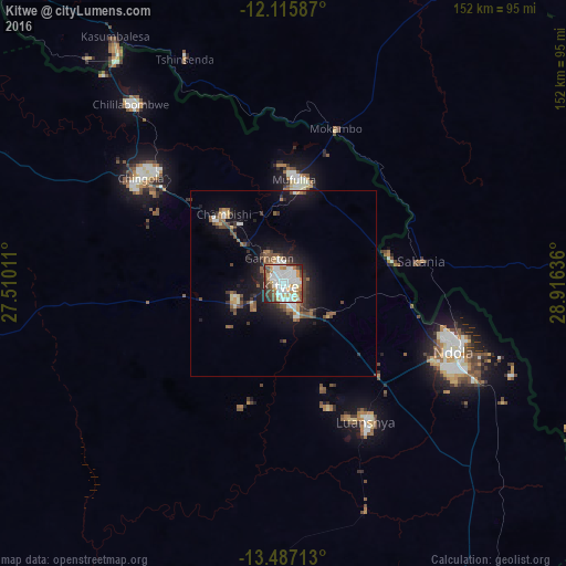
Analysis of Kitwe night lights 2016
Square area 10x10 km:
 27.49%
90-99
27.27%80-89
2.6%70-79
14.29%60-69
6.06%50-59
4.76%40-49
9.52%30-39
4.33%20-29
3.68%10-19
0%0-9
0%Square area 50x50 km:
1.5%90-99
1.63%80-89
0.46%70-79
1.01%60-69
0.9%50-59
1.63%40-49
1.9%30-39
1.37%20-29
2.08%10-19
7.03%0-9
80.48%Clear (daylight) street map image can be seen on geolist.org.
Map coordinates:
12° 6' 57.1" South, 27° 30' 36.4" East
12° 48' 8.7" South, 28° 12' 47.6" East
13° 29' 13.7" South, 28° 54' 58.9" East
Some cities around Kitwe sort by population:
• Ndola
49.1 km =30.5 mi,  110°
110°
• Chingola
46.9 km =29.1 mi,  310°
310°
• Mufulira
28.2 km =17.5 mi,  6°
6°
• Luanshya
43.2 km =26.8 mi,  149°
149°
• Kalulushi
13.6 km =8.5 mi,  251°
251°
• Chililabombwe
64.5 km =40.1 mi,  318°
318°
• Chambishi
25.6 km =15.9 mi, 317°
• Mpongwe
78.8 km =49 mi,  184°
184°
911148 (p: 400,914)
Sources (retrieved 2019-11-25):
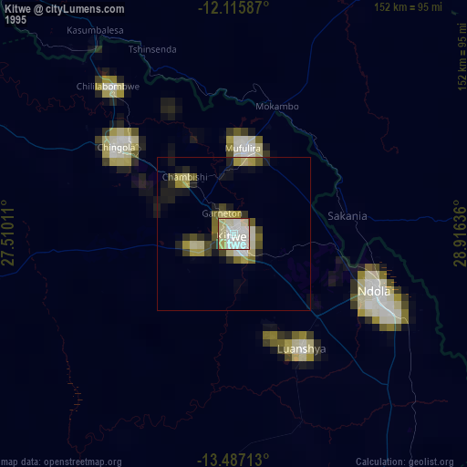
» NASA, Earths city lights 1995
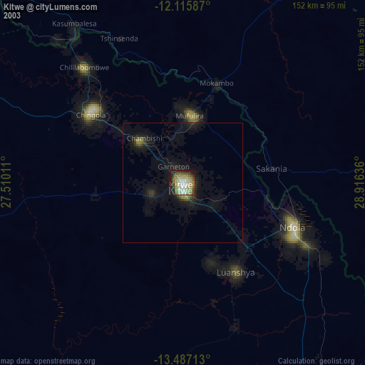
» NASA city lights 2003
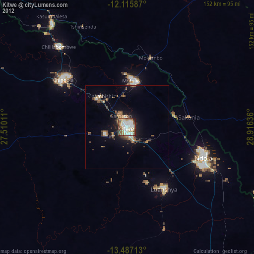
» Earth at Night: Flat Maps 2012, 2016