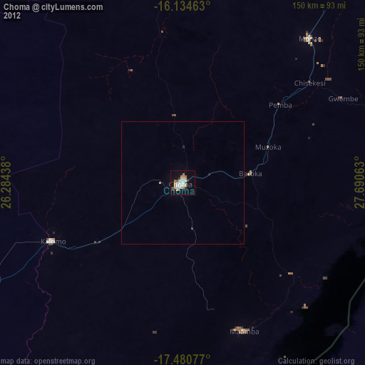
Choma night lights from space
Night Light of Choma (Southern) from space (Zambia) Src. Average luminocity for 10x10km area is 30.7511% and for 50x50km: 1.3734%.

Analysis of Choma night lights 2016
Square area 10x10 km:
 1.08%
1.08%90-99
5.84%80-89
11.9%70-79
2.81%60-69
1.73%50-59
1.52%40-49
6.28%30-39
2.16%20-29
1.3%10-19
29.65%0-9
35.71%Square area 50x50 km:
0.04%90-99
0.23%80-89
0.46%70-79
0.11%60-69
0.07%50-59
0.06%40-49
0.27%30-39
0.09%20-29
0.08%10-19
1.23%0-9
97.37%Clear (daylight) street map image can be seen on geolist.org.
Map coordinates:
16° 8' 4.7" South, 26° 17' 3.8" East
16° 48' 32" South, 26° 59' 15" East
17° 28' 50.8" South, 27° 41' 26.3" East
Some cities around Choma sort by population:
• Livingstone
166.3 km =103.3 mi,  226°
226°
• Mazabuka
133.5 km =83 mi,  37°
37°
• Kafue
172 km =106.9 mi,  47°
47°
• Victoria Falls, ZW
175.2 km =108.9 mi,  224°
224°
• Monze
78.8 km =49 mi, 42°
• Maamba
64.4 km =40 mi,  164°
164°
• Sinazongwe
71.2 km =44.2 mi,  134°
134°
• Nakambala
137.6 km =85.5 mi, 37°
917748 (p: 46,746)
Sources (retrieved 2019-11-25):
» Earth at Night: Flat Maps 2012, 2016