Zeerust night lights from space
Night Light of Zeerust (North-West) from space (South Africa) Src. Average luminocity for 10x10km area is 16.9028% and for 50x50km: 1.6576%.
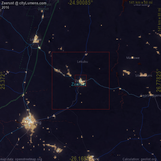
Analysis of Zeerust night lights 2016
Square area 10x10 km:
 0.4%
0.4%90-99
0.4%80-89
1.59%70-79
6.94%60-69
4.17%50-59
2.38%40-49
4.76%30-39
0.6%20-29
0.2%10-19
1.39%0-9
77.18%Square area 50x50 km:
0.02%90-99
0.02%80-89
0.08%70-79
0.5%60-69
0.32%50-59
0.24%40-49
0.6%30-39
0.31%20-29
0.36%10-19
0.19%0-9
97.36%Clear (daylight) street map image can be seen on geolist.org.
Map coordinates:
24° 54' 3.1" South, 25° 22' 19.2" East
25° 32' 13" South, 26° 4' 30.4" East
26° 10' 10.9" South, 26° 46' 41.7" East
Some cities around Zeerust sort by population:
• Mmabatho
56.3 km =35 mi,  231°
231°
• Lichtenburg
68.9 km =42.8 mi,  172°
172°
• Lobatse, BW
53 km =32.9 mi,  311°
311°
• Ramotswa, BW
76.8 km =47.7 mi,  344°
344°
• Janeng, BW
54.4 km =33.8 mi,  284°
284°
• Mahikeng
56.5 km =35.1 mi, 229°
• Koster
90 km =55.9 mi,  113°
113°
• Otse, BW
67.3 km =41.8 mi,  329°
329°
937136 (p: 17,708)
Sources (retrieved 2019-11-25):
» Earth at Night: Flat Maps 2012, 2016