Lobatse night lights from space
Night Light of Lobatse from space (Botswana) Src. Average luminocity for 10x10km area is 21.9901% and for 50x50km: 1.502%.
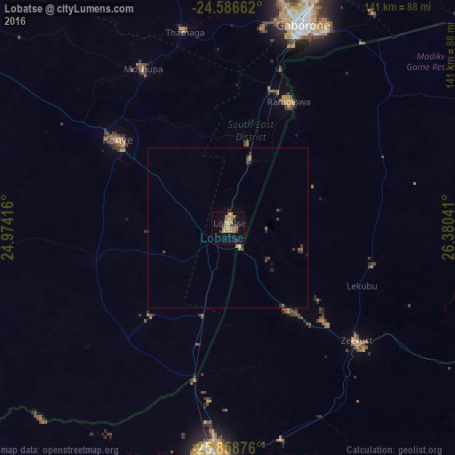
Analysis of Lobatse night lights 2016
Square area 10x10 km:
100  0%
0%
90-99 0%
80-89 4.76%
70-79 8.73%
60-69 6.35%
50-59 0%
40-49 2.38%
30-39 2.38%
20-29 1.98%
10-19 12.7%
0-9 60.71%
0%90-99
0%80-89
4.76%70-79
8.73%60-69
6.35%50-59
0%40-49
2.38%30-39
2.38%20-29
1.98%10-19
12.7%0-9
60.71%Square area 50x50 km:
100 0.02%
90-99 0.02%
80-89 0.19%
70-79 0.42%
60-69 0.34%
50-59 0.12%
40-49 0.28%
30-39 0.33%
20-29 0.34%
10-19 0.56%
0-9 97.39%
0.02%90-99
0.02%80-89
0.19%70-79
0.42%60-69
0.34%50-59
0.12%40-49
0.28%30-39
0.33%20-29
0.34%10-19
0.56%0-9
97.39%Clear (daylight) street map image can be seen on geolist.org.
Map coordinates:
24° 35' 11.8" South, 24° 58' 27" East
25° 13' 27.7" South, 25° 40' 38.2" East
25° 51' 31.5" South, 26° 22' 49.5" East
Some cities around Lobatse sort by population:
• Kanye
45 km =28 mi,  309°
309°
• Ramotswa
43.8 km =27.2 mi,  26°
26°
• Thamaga
63.2 km =39.3 mi,  347°
347°
• Mosopa
56.5 km =35.1 mi,  332°
332°
• Zeerust, ZA
53 km =32.9 mi,  131°
131°
• Janeng
24.9 km =15.5 mi,  210°
210°
• Gabane
62.9 km =39.1 mi,  9°
9°
• Otse
23.8 km =14.8 mi, 13°
933521 (p: 30,883)
Sources (retrieved 2019-11-25):
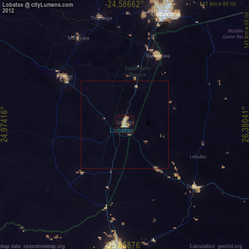
» Earth at Night: Flat Maps 2012, 2016