Mahikeng night lights from space
Night Light of Mahikeng (North-West) from space (South Africa) Src. Average luminocity for 10x10km area is 67.2727% and for 50x50km: 7.3321%.
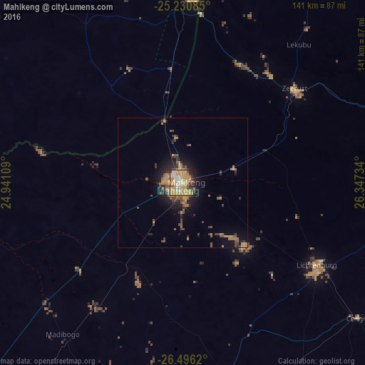
Analysis of Mahikeng night lights 2016
Square area 10x10 km:
 7.95%
7.95%90-99
8.71%80-89
10.42%70-79
32.58%60-69
13.83%50-59
3.22%40-49
5.49%30-39
6.25%20-29
5.68%10-19
5.87%0-9
0%Square area 50x50 km:
0.36%90-99
0.42%80-89
0.66%70-79
2.38%60-69
1.55%50-59
0.94%40-49
1.47%30-39
1.13%20-29
1.6%10-19
4.38%0-9
85.09%Clear (daylight) street map image can be seen on geolist.org.
Map coordinates:
25° 13' 51.1" South, 24° 56' 27.9" East
25° 51' 54.8" South, 25° 38' 39.2" East
26° 29' 46.3" South, 26° 20' 50.4" East
Some cities around Mahikeng sort by population:
• Mmabatho
2 km =1.2 mi,  327°
327°
• Lichtenburg
60.6 km =37.7 mi,  121°
121°
• Kanye, BW
104.7 km =65.1 mi,  342°
342°
• Lobatse, BW
71.3 km =44.3 mi,  2°
2°
• Ramotswa, BW
112.8 km =70.1 mi,  11°
11°
• Zeerust
56.5 km =35.1 mi,  49°
49°
• Janeng, BW
50.8 km =31.6 mi,  349°
349°
• Otse, BW
94.8 km =58.9 mi, 5°
980595 (p: 14,000)
Sources (retrieved 2019-11-25):
» Earth at Night: Flat Maps 2012, 2016