Otse night lights from space
Night Light of Otse (South-East) from space (Botswana) Src. Average luminocity for 10x10km area is 4.5341% and for 50x50km: 1.9184%.
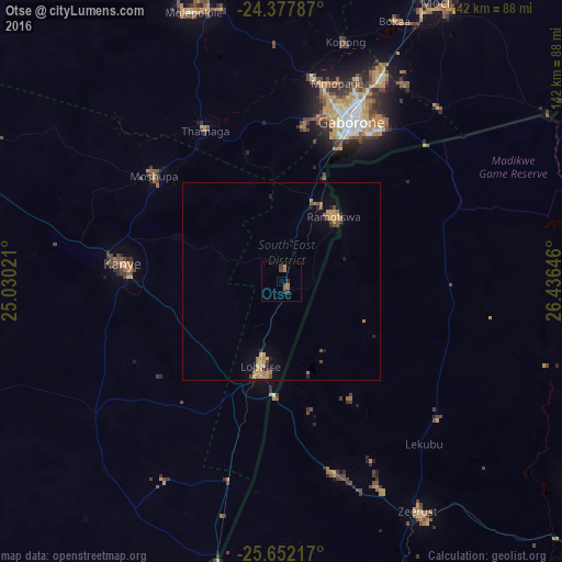
Analysis of Otse night lights 2016
Square area 10x10 km:
 0%
0%90-99
0%80-89
0%70-79
0.38%60-69
2.65%50-59
0.19%40-49
1.52%30-39
2.08%20-29
1.52%10-19
0%0-9
91.67%Square area 50x50 km:
0%90-99
0%80-89
0.24%70-79
0.66%60-69
0.52%50-59
0.18%40-49
0.39%30-39
0.26%20-29
0.27%10-19
0.59%0-9
96.9%Clear (daylight) street map image can be seen on geolist.org.
Map coordinates:
24° 22' 40.3" South, 25° 1' 48.8" East
25° 1' 0" South, 25° 43' 60" East
25° 39' 7.8" South, 26° 26' 11.3" East
Some cities around Otse sort by population:
• Gaborone
44 km =27.3 mi,  23°
23°
• Kanye
40.8 km =25.4 mi,  277°
277°
• Mogoditshane
45.3 km =28.1 mi, 17°
• Lobatse
23.8 km =14.8 mi,  193°
193°
• Ramotswa
21.2 km =13.2 mi,  40°
40°
• Thamaga
43.2 km =26.8 mi,  333°
333°
• Mosopa
41.6 km =25.8 mi,  310°
310°
• Gabane
39.2 km =24.4 mi,  7°
7°
933184 (p: 6,275)
Sources (retrieved 2019-11-25):
» Earth at Night: Flat Maps 2012, 2016