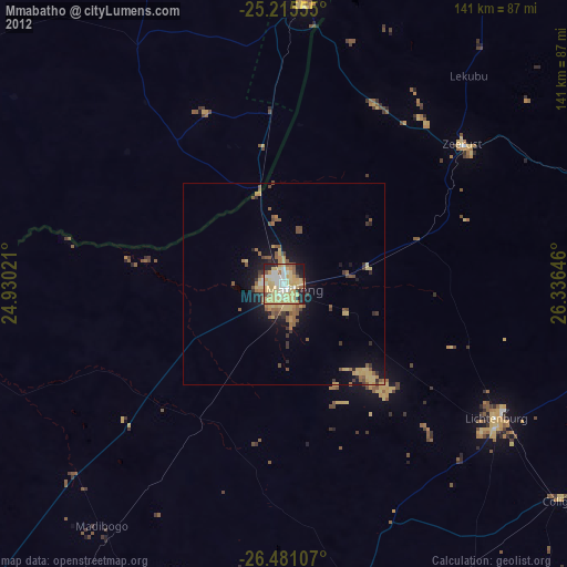
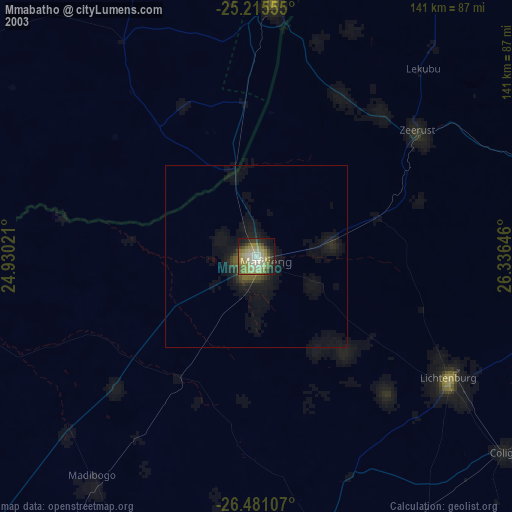
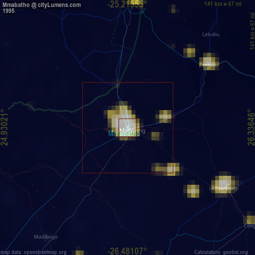
Mmabatho night lights from space
Night Light of Mmabatho (North-West) from space (South Africa) Src. Average luminocity for 10x10km area is 67.1231% and for 50x50km: 7.0654%.
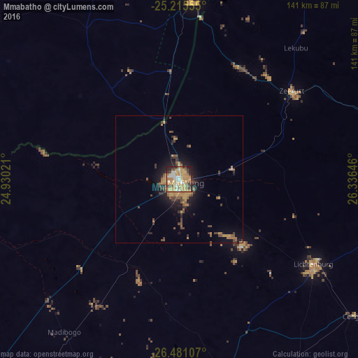
Analysis of Mmabatho night lights 2016
Square area 10x10 km:
 8.52%
8.52%90-99
10.04%80-89
9.28%70-79
30.11%60-69
13.45%50-59
4.17%40-49
6.06%30-39
6.82%20-29
8.14%10-19
3.41%0-9
0%Square area 50x50 km:
0.36%90-99
0.42%80-89
0.59%70-79
2.26%60-69
1.54%50-59
0.9%40-49
1.4%30-39
1.09%20-29
1.58%10-19
4.28%0-9
85.57%Clear (daylight) street map image can be seen on geolist.org.
Map coordinates:
25° 12' 56" South, 24° 55' 48.8" East
25° 51' 0" South, 25° 37' 60" East
26° 28' 51.9" South, 26° 20' 11.3" East
Some cities around Mmabatho sort by population:
• Lichtenburg
62.4 km =38.8 mi,  122°
122°
• Kanye, BW
102.7 km =63.8 mi,  342°
342°
• Lobatse, BW
69.7 km =43.3 mi,  3°
3°
• Ramotswa, BW
111.4 km =69.2 mi,  12°
12°
• Zeerust
56.3 km =35 mi,  51°
51°
• Janeng, BW
48.9 km =30.4 mi,  350°
350°
• Mahikeng
2 km =1.2 mi,  147°
147°
• Otse, BW
93.2 km =57.9 mi, 6°
975436 (p: 76,754)
Sources (retrieved 2019-11-25):
» NASA, Earths city lights 1995
» NASA city lights 2003
» Earth at Night: Flat Maps 2012, 2016