Polokwane night lights from space
Night Light of Polokwane (Limpopo) from space (South Africa) Src. Average luminocity for 10x10km area is 82.3591% and for 50x50km: 13.225%.
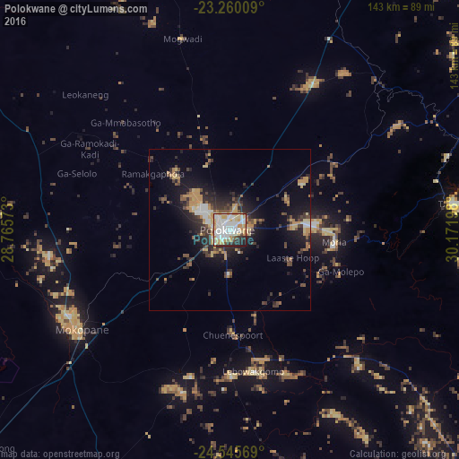
Analysis of Polokwane night lights 2016
Square area 10x10 km:
 28.97%
90-99
27.18%80-89
9.52%70-79
16.47%60-69
1.59%50-59
1.59%40-49
3.57%30-39
3.57%20-29
6.94%10-19
0.6%0-9
0%Square area 50x50 km:
1.74%90-99
1.66%80-89
1.76%70-79
2.88%60-69
0.93%50-59
1.01%40-49
2.48%30-39
2.44%20-29
4.28%10-19
7.67%0-9
73.15%Clear (daylight) street map image can be seen on geolist.org.
Map coordinates:
23° 15' 36.3" South, 28° 45' 56.6" East
23° 54' 16.2" South, 29° 28' 7.9" East
24° 32' 44.5" South, 30° 10' 19.1" East
Some cities around Polokwane sort by population:
• Mokopane
56.7 km =35.2 mi,  235°
235°
• Lebowakgomo
33 km =20.5 mi,  174°
174°
• Nkowakowa
83.2 km =51.7 mi,  88°
88°
• Duiwelskloof
72.2 km =44.9 mi,  71°
71°
• Tzaneen
71.1 km =44.2 mi,  83°
83°
• Ga-Kgapane
82.1 km =51 mi, 69°
• Mankoeng
35.4 km =22 mi, 89°
• Bochum
76.5 km =47.5 mi,  333°
333°
965289 (p: 123,749)
Sources (retrieved 2019-11-25):
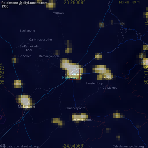
» NASA, Earths city lights 1995
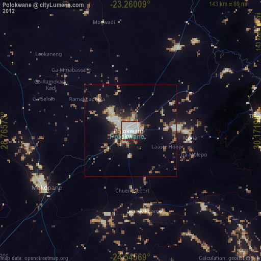
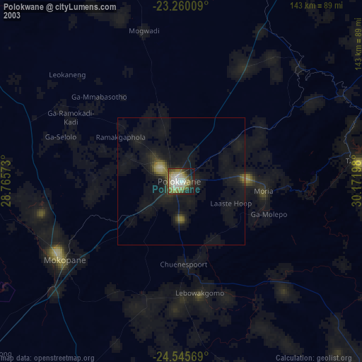
» NASA city lights 2003
» Earth at Night: Flat Maps 2012, 2016