Mokopane night lights from space
Night Light of Mokopane (Limpopo) from space (South Africa) Src. Average luminocity for 10x10km area is 36.0436% and for 50x50km: 5.1739%.
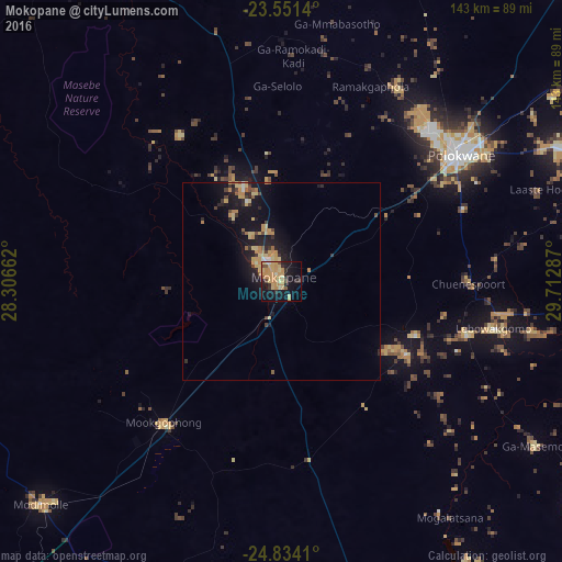
Analysis of Mokopane night lights 2016
Square area 10x10 km:
 0.57%
0.57%90-99
0.19%80-89
11.93%70-79
15.34%60-69
5.3%50-59
2.46%40-49
2.46%30-39
3.03%20-29
6.63%10-19
29.17%0-9
22.92%Square area 50x50 km:
0.11%90-99
0.13%80-89
1.43%70-79
1.36%60-69
0.68%50-59
0.44%40-49
0.46%30-39
0.63%20-29
1.33%10-19
5.75%0-9
87.69%Clear (daylight) street map image can be seen on geolist.org.
Map coordinates:
23° 33' 5" South, 28° 18' 23.8" East
24° 11' 39.7" South, 29° 0' 35.1" East
24° 50' 2.8" South, 29° 42' 46.3" East
Some cities around Mokopane sort by population:
• Polokwane
56.7 km =35.2 mi,  55°
55°
• Warmbaths
106.1 km =65.9 mi,  223°
223°
• Lebowakgomo
49.7 km =30.9 mi,  90°
90°
• Siyabuswa
102.2 km =63.5 mi,  178°
178°
• Modimolle
83.5 km =51.9 mi,  227°
227°
• Tzaneen
123.9 km =77 mi,  71°
71°
• Mankoeng
88.2 km =54.8 mi, 68°
• Bochum
101.9 km =63.3 mi,  7°
7°
964315 (p: 101,090)
Sources (retrieved 2019-11-25):
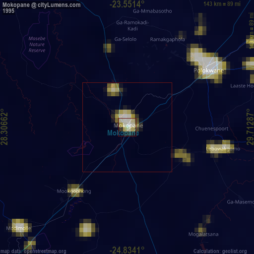
» NASA, Earths city lights 1995
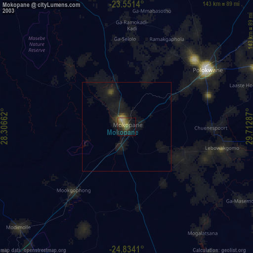
» NASA city lights 2003
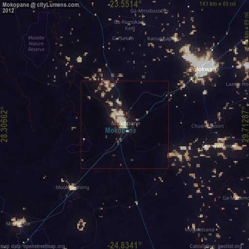
» Earth at Night: Flat Maps 2012, 2016