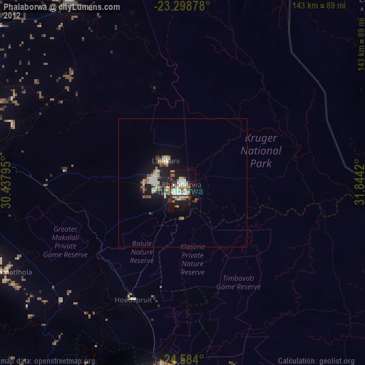
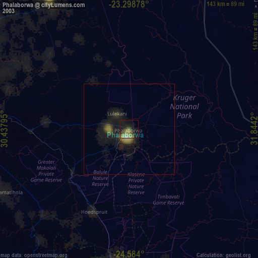
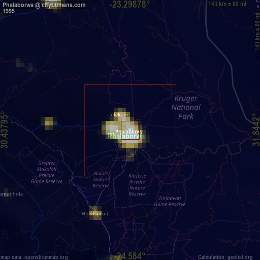
Phalaborwa night lights from space
Night Light of Phalaborwa (Limpopo) from space (South Africa) Src. Average luminocity for 10x10km area is 40.8523% and for 50x50km: 5.8431%.
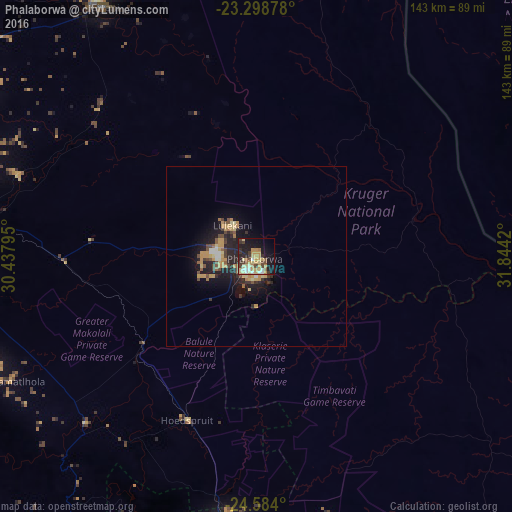
Analysis of Phalaborwa night lights 2016
Square area 10x10 km:
 3.22%
3.22%90-99
3.79%80-89
12.69%70-79
10.04%60-69
3.98%50-59
2.08%40-49
6.82%30-39
6.06%20-29
8.14%10-19
29.17%0-9
14.02%Square area 50x50 km:
0.29%90-99
0.38%80-89
1.14%70-79
1.69%60-69
0.45%50-59
0.53%40-49
1.04%30-39
0.75%20-29
2.14%10-19
5.02%0-9
86.57%Clear (daylight) street map image can be seen on geolist.org.
Map coordinates:
23° 17' 55.6" South, 30° 26' 16.6" East
23° 56' 34.8" South, 31° 8' 27.9" East
24° 35' 2.4" South, 31° 50' 39.1" East
Some cities around Phalaborwa sort by population:
• Thohoyandou
129.5 km =80.5 mi,  328°
328°
• Giyani
83.2 km =51.7 mi, 328°
• Nkowakowa
87 km =54.1 mi,  274°
274°
• Duiwelskloof
105.5 km =65.6 mi,  285°
285°
• Tzaneen
100.1 km =62.2 mi,  277°
277°
• Ga-Kgapane
99.1 km =61.6 mi, 289°
• Mankoeng
134.7 km =83.7 mi, 272°
• Thulamahashi
87.1 km =54.1 mi,  176°
176°
965528 (p: 109,468)
Sources (retrieved 2019-11-25):
» NASA, Earths city lights 1995
» NASA city lights 2003
» Earth at Night: Flat Maps 2012, 2016