Thulamahashi night lights from space
Night Light of Thulamahashi (Limpopo) from space (South Africa) Src. Average luminocity for 10x10km area is 16.3512% and for 50x50km: 7.9539%.
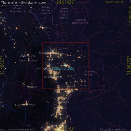
Analysis of Thulamahashi night lights 2016
Square area 10x10 km:
 1.19%
1.19%90-99
0.6%80-89
0.6%70-79
2.38%60-69
3.97%50-59
1.59%40-49
6.15%30-39
3.57%20-29
3.57%10-19
4.17%0-9
72.22%Square area 50x50 km:
0.06%90-99
0.19%80-89
0.51%70-79
1.4%60-69
1.31%50-59
1.35%40-49
2.5%30-39
2.42%20-29
2%10-19
7%0-9
81.28%Clear (daylight) street map image can be seen on geolist.org.
Map coordinates:
24° 5' 3.4" South, 30° 29' 46.6" East
24° 43' 28.5" South, 31° 11' 57.8" East
25° 21' 41.8" South, 31° 54' 9.1" East
Some cities around Thulamahashi sort by population:
• Nelspruit
86.5 km =53.7 mi,  195°
195°
• Ressano Garcia, MZ
113.1 km =70.3 mi,  134°
134°
• Phalaborwa
87.1 km =54.1 mi,  356°
356°
• Barberton
119.2 km =74.1 mi,  187°
187°
• Nkowakowa
131.2 km =81.5 mi,  315°
315°
• Lydenburg
86.7 km =53.9 mi,  241°
241°
• Komatipoort
109.5 km =68 mi,  136°
136°
• White River
70.1 km =43.6 mi, 195°
949026 (p: 11,655)
Sources (retrieved 2019-11-25):
» Earth at Night: Flat Maps 2012, 2016