Louis Trichardt night lights from space
Night Light of Louis Trichardt (Limpopo) from space (South Africa) Src. Average luminocity for 10x10km area is 33.0079% and for 50x50km: 8.0729%.
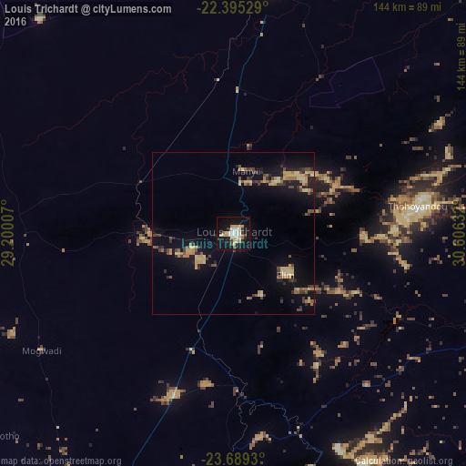
Analysis of Louis Trichardt night lights 2016
Square area 10x10 km:
 4.76%
4.76%90-99
4.17%80-89
12.3%70-79
2.78%60-69
2.18%50-59
1.59%40-49
2.38%30-39
1.59%20-29
3.17%10-19
43.65%0-9
21.43%Square area 50x50 km:
0.22%90-99
0.32%80-89
2.09%70-79
1.26%60-69
1.1%50-59
0.75%40-49
1.4%30-39
1.22%20-29
1.37%10-19
7.6%0-9
82.66%Clear (daylight) street map image can be seen on geolist.org.
Map coordinates:
22° 23' 43" South, 29° 12' 0.3" East
23° 2' 37.9" South, 29° 54' 11.5" East
23° 41' 21.5" South, 30° 36' 22.8" East
Some cities around Louis Trichardt sort by population:
• Thohoyandou
60.5 km =37.6 mi,  79°
79°
• Giyani
88.2 km =54.8 mi,  109°
109°
• Beitbridge, ZW
92.5 km =57.5 mi,  6°
6°
• Duiwelskloof
76.2 km =47.3 mi,  161°
161°
• Tzaneen
91.7 km =57 mi, 163°
• Ga-Kgapane
74.3 km =46.2 mi,  153°
153°
• Mankoeng
95.6 km =59.4 mi,  185°
185°
• Bochum
82.6 km =51.3 mi,  250°
250°
981827 (p: 86,854)
Sources (retrieved 2019-11-25):
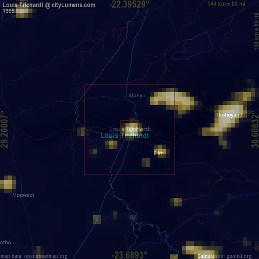
» NASA, Earths city lights 1995
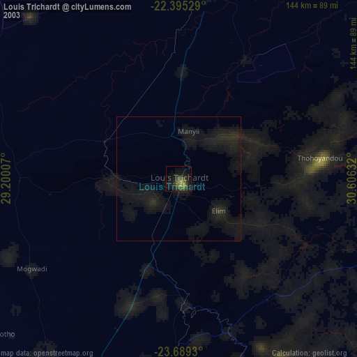
» NASA city lights 2003
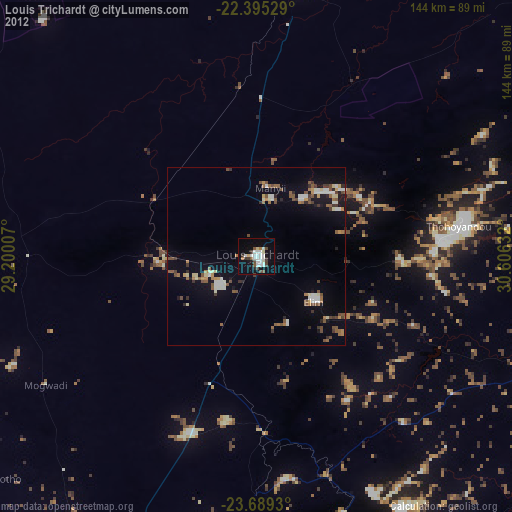
» Earth at Night: Flat Maps 2012, 2016