Lindley night lights from space
Night Light of Lindley (Orange Free State) from space (South Africa) Src. Average luminocity for 10x10km area is 8.1742% and for 50x50km: 0.5719%.
Analysis of Lindley night lights 2016
Square area 10x10 km:
 0%
0%90-99
0%80-89
1.89%70-79
3.79%60-69
2.65%50-59
0%40-49
0%30-39
1.52%20-29
0%10-19
0.76%0-9
89.39%Square area 50x50 km:
0%90-99
0%80-89
0.14%70-79
0.24%60-69
0.24%50-59
0%40-49
0%30-39
0.09%20-29
0.03%10-19
0.06%0-9
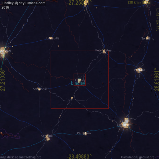
99.21%Clear (daylight) street map image can be seen on geolist.org.
Map coordinates:
27° 15' 20.9" South, 27° 12' 37.3" East
27° 52' 44.8" South, 27° 54' 48.5" East
28° 29' 55.8" South, 28° 36' 59.8" East
Some cities around Lindley sort by population:
• Kroonstad
71.4 km =44.4 mi,  290°
290°
• Bethlehem
55 km =34.2 mi,  135°
135°
• Heilbron
66.7 km =41.4 mi,  4°
4°
• Senekal
56.8 km =35.3 mi,  210°
210°
• Hennenman
88 km =54.7 mi,  262°
262°
• Reitz
51.2 km =31.8 mi,  80°
80°
• Koppies
78.4 km =48.7 mi,  334°
334°
• Ventersburg
79.5 km =49.4 mi,  253°
253°
982701 (p: 12,000)
Sources (retrieved 2019-11-25):
» Earth at Night: Flat Maps 2012, 2016