Ventersburg night lights from space
Night Light of Ventersburg (Orange Free State) from space (South Africa) Src. Average luminocity for 10x10km area is 3.9583% and for 50x50km: 1.4164%.
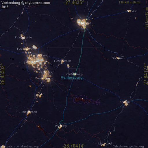
Analysis of Ventersburg night lights 2016
Square area 10x10 km:
 0%
0%90-99
0%80-89
0.19%70-79
2.08%60-69
1.52%50-59
0%40-49
0.95%30-39
0.57%20-29
0%10-19
0%0-9
94.7%Square area 50x50 km:
0.02%90-99
0.06%80-89
0.14%70-79
0.39%60-69
0.34%50-59
0.16%40-49
0.28%30-39
0.17%20-29
0.21%10-19
0.8%0-9
97.42%Clear (daylight) street map image can be seen on geolist.org.
Map coordinates:
27° 27' 48.6" South, 26° 26' 6.1" East
28° 5' 8.2" South, 27° 8' 17.3" East
28° 42' 14.9" South, 27° 50' 28.6" East
Some cities around Ventersburg sort by population:
• Welkom
41.3 km =25.7 mi,  286°
286°
• Virginia
26.8 km =16.7 mi,  265°
265°
• Kroonstad
49.3 km =30.6 mi,  11°
11°
• Kutloanong
47.3 km =29.4 mi,  306°
306°
• Senekal
54 km =33.6 mi,  118°
118°
• Theunissen
56 km =34.8 mi,  229°
229°
• Hennenman
16.5 km =10.3 mi,  317°
317°
• Winburg
49.7 km =30.9 mi,  194°
194°
944540 (p: 10,698)
Sources (retrieved 2019-11-25):
» Earth at Night: Flat Maps 2012, 2016