Kirkwood night lights from space
Night Light of Kirkwood (Eastern Cape) from space (South Africa) Src. Average luminocity for 10x10km area is 6.8392% and for 50x50km: 0.5063%.
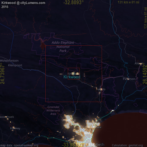
Analysis of Kirkwood night lights 2016
Square area 10x10 km:
 0%
0%90-99
0%80-89
0.7%70-79
2.8%60-69
0.7%50-59
2.1%40-49
0.87%30-39
1.92%20-29
1.4%10-19
1.05%0-9
88.46%Square area 50x50 km:
0%90-99
0%80-89
0.03%70-79
0.13%60-69
0.09%50-59
0.09%40-49
0.12%30-39
0.24%20-29
0.21%10-19
0.13%0-9
98.97%Clear (daylight) street map image can be seen on geolist.org.
Map coordinates:
32° 48' 33.5" South, 24° 44' 22.8" East
33° 23' 53.8" South, 25° 26' 34" East
33° 58' 60" South, 26° 8' 45.3" East
Some cities around Kirkwood sort by population:
• Port Elizabeth
64.6 km =40.1 mi,  165°
165°
• Uitenhage
40.2 km =25 mi,  186°
186°
• Grahamstown
101.8 km =63.3 mi,  84°
84°
• Fort Beaufort
130.8 km =81.3 mi,  58°
58°
• Kruisfontein
94.1 km =58.5 mi,  224°
224°
• Port Alfred
135.2 km =84 mi,  98°
98°
• Somerset East
76.4 km =47.5 mi,  10°
10°
• Adelaide
110.5 km =68.7 mi,  45°
45°
990802 (p: 10,148)
Sources (retrieved 2019-11-25):
» Earth at Night: Flat Maps 2012, 2016