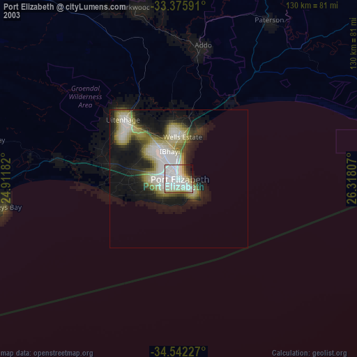
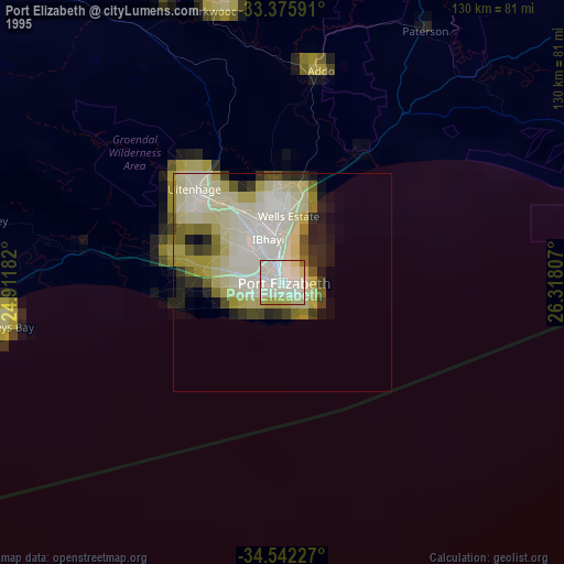
Port Elizabeth night lights from space
Night Light of Port Elizabeth (Eastern Cape) from space (South Africa) Src. Average luminocity for 10x10km area is 71.7448% and for 50x50km: 19.1936%.
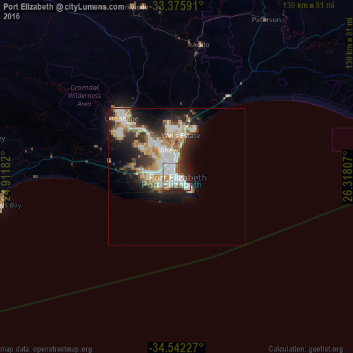

Analysis of Port Elizabeth night lights 2016
Square area 10x10 km:
 31.29%
90-99
20.1%80-89
1.05%70-79
4.2%60-69
8.22%50-59
5.07%40-49
5.94%30-39
6.82%20-29
11.71%10-19
5.59%0-9
0%Square area 50x50 km:
4.45%90-99
4.12%80-89
1.36%70-79
2.68%60-69
2.86%50-59
2.07%40-49
1.89%30-39
2.74%20-29
5.38%10-19
7.64%0-9
64.81%Clear (daylight) street map image can be seen on geolist.org.
Map coordinates:
33° 22' 33.3" South, 24° 54' 42.6" East
33° 57' 39.9" South, 25° 36' 53.8" East
34° 32' 32.2" South, 26° 19' 5.1" East
Some cities around Port Elizabeth sort by population:
• Uitenhage
30.3 km =18.8 mi,  318°
318°
• Grahamstown
112 km =69.6 mi,  49°
49°
• Fort Beaufort
162.3 km =100.8 mi,  35°
35°
• Kruisfontein
81.6 km =50.7 mi,  266°
266°
• Somerset East
137.8 km =85.6 mi,  358°
358°
• Adelaide
153.1 km =95.1 mi,  24°
24°
• Kirkwood
64.6 km =40.1 mi,  345°
345°
• Alice
172.8 km =107.4 mi, 40°
964420 (p: 967,677)
Sources (retrieved 2019-11-25):
» NASA, Earths city lights 1995
» NASA city lights 2003
» Earth at Night: Flat Maps 2012, 2016