Glencoe night lights from space
Night Light of Glencoe (KwaZulu-Natal) from space (South Africa) Src. Average luminocity for 10x10km area is 13.0337% and for 50x50km: 1.6082%.
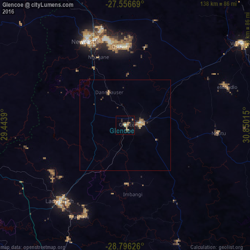
Analysis of Glencoe night lights 2016
Square area 10x10 km:
 0%
0%90-99
0.79%80-89
0.99%70-79
3.97%60-69
4.17%50-59
0.4%40-49
0%30-39
2.58%20-29
3.77%10-19
8.73%0-9
74.6%Square area 50x50 km:
0.03%90-99
0.12%80-89
0.2%70-79
0.41%60-69
0.41%50-59
0.1%40-49
0.15%30-39
0.25%20-29
0.31%10-19
0.98%0-9
97.03%Clear (daylight) street map image can be seen on geolist.org.
Map coordinates:
27° 33' 24.1" South, 29° 26' 38" East
28° 10' 41.8" South, 30° 8' 49.3" East
28° 47' 46.5" South, 30° 51' 0.5" East
Some cities around Glencoe sort by population:
• Newcastle
51.3 km =31.9 mi,  335°
335°
• Vryheid
77.9 km =48.4 mi,  54°
54°
• Dundee
8.6 km =5.3 mi,  81°
81°
• Mondlo
60 km =37.3 mi,  68°
68°
• Volksrust
94.1 km =58.5 mi, 343°
• Harrismith
100.2 km =62.3 mi,  263°
263°
• Ekuvukeni
32.2 km =20 mi,  178°
178°
• Greytown
107.7 km =66.9 mi,  156°
156°
1001736 (p: 13,547)
Sources (retrieved 2019-11-25):
» Earth at Night: Flat Maps 2012, 2016