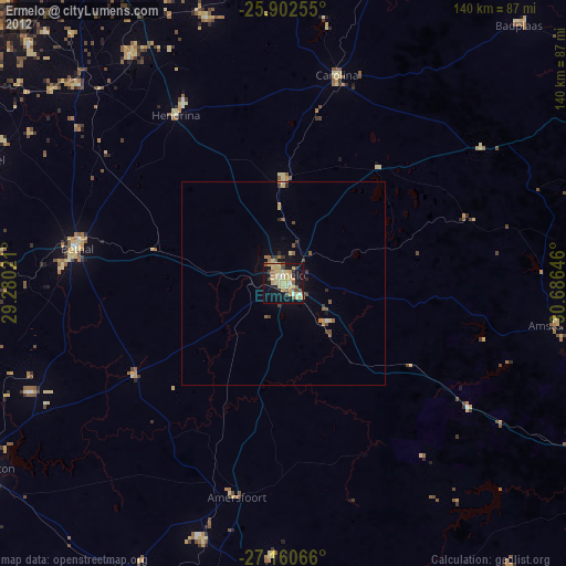
Ermelo night lights from space
Night Light of Ermelo (Mpumalanga) from space (South Africa) Src. Average luminocity for 10x10km area is 40.0492% and for 50x50km: 2.7001%.
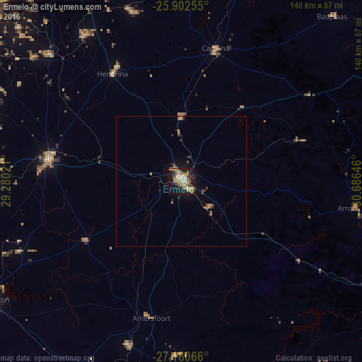
Analysis of Ermelo night lights 2016
Square area 10x10 km:
 3.79%
3.79%90-99
4.36%80-89
7.39%70-79
11.55%60-69
7.01%50-59
5.11%40-49
4.73%30-39
0.95%20-29
4.92%10-19
39.2%0-9
10.98%Square area 50x50 km:
0.15%90-99
0.18%80-89
0.39%70-79
0.67%60-69
0.47%50-59
0.25%40-49
0.39%30-39
0.35%20-29
0.42%10-19
2.42%0-9
94.31%Clear (daylight) street map image can be seen on geolist.org.
Map coordinates:
25° 54' 9.2" South, 29° 16' 48.8" East
26° 31' 60" South, 29° 58' 60" East
27° 9' 38.4" South, 30° 41' 11.3" East
Some cities around Ermelo sort by population:
• eMbalenhle
91.2 km =56.7 mi,  270°
270°
• Bethal
52.2 km =32.4 mi,  279°
279°
• Standerton
86.1 km =53.5 mi,  238°
238°
• Driefontein
71 km =44.1 mi,  139°
139°
• Secunda
81.3 km =50.5 mi, 268°
• Hendrina
49.5 km =30.8 mi,  327°
327°
• Kriel
80.8 km =50.2 mi,  290°
290°
• Breyten
25.8 km =16 mi,  0°
0°
1005125 (p: 41,124)
Sources (retrieved 2019-11-25):
» Earth at Night: Flat Maps 2012, 2016