Đinh Văn night lights from space
Night Light of Đinh Văn (Lâm Đồng) from space (Vietnam) Src. Average luminocity for 10x10km area is 0.7583% and for 50x50km: 6.0806%.
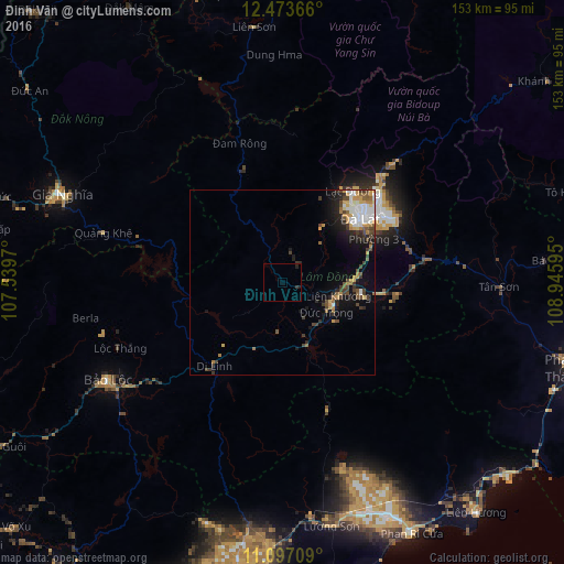
Analysis of Đinh Văn night lights 2016
Square area 10x10 km:
 0%
0%90-99
0%80-89
0%70-79
0%60-69
0%50-59
0%40-49
0%30-39
1.24%20-29
1.03%10-19
0.41%0-9
97.31%Square area 50x50 km:
1.14%90-99
0.87%80-89
0.41%70-79
1.08%60-69
0.55%50-59
0.74%40-49
1.16%30-39
1.2%20-29
1.2%10-19
3.16%0-9
88.5%Clear (daylight) street map image can be seen on geolist.org.
Map coordinates:
12° 28' 25.2" North, 107° 32' 22.9" East
11° 47' 10.5" North, 108° 14' 34.2" East
11° 5' 49.5" North, 108° 56' 45.4" East
Some cities around Đinh Văn sort by population:
• Ðà Lạt
28 km =17.4 mi,  50°
50°
• Đưc Trọng
15.3 km =9.5 mi,  111°
111°
• Phan Thiết
96.6 km =60 mi,  189°
189°
• Bảo Lộc
54.3 km =33.7 mi,  240°
240°
• Buôn Ma Thuột
100.5 km =62.4 mi,  347°
347°
• Cam Ranh
100.8 km =62.6 mi,  81°
81°
• Phan Rang-Tháp Chàm
84.9 km =52.8 mi, 106°
• Gia Nghĩa
64.8 km =40.3 mi,  291°
291°
8991407 (p: 16,036)
Sources (retrieved 2019-11-25):
» Earth at Night: Flat Maps 2012, 2016